Copyright Santa Rosa Press Democrat
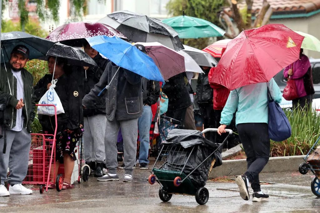
The arrival of what the National Weather Service called a “moderate scale” atmospheric river storm — the second such storm already in November — continued to make its approach toward the Bay Area on Wednesday, with the likely touch down sometime in the evening and a 24-hour stay anticipated. The National Weather Service said the storm center continued to develop early Wednesday northwest of San Francisco, and it will bring with it a strong cold front that will mix with the high pressure that’s created the dry conditions of the past few days. Combined, that will produce mighty strong winds, rain, and the possibility of thunder and lightning for some areas of the region, while other covered in a rain shadow may stay relatively untouched. “It’s deepening quickly,” NWS meteorologist Rick Canepa said of the storm center. “It’s not moving too much but rather developing in place. We’re seeing rapid (barometric) pressure falls over a 24-hour period and it’s going to mix with the surface high pressure that’s been over the land.” The increased instability of the atmosphere as the storm develops more over land is expected to create southerly winds that are expected to reach 15 to 25 mph and gust up to 50 mph in Alameda, Contra Costa, San Mateo and Santa Cruz counties, according to the weather service. In areas of Sonoma and Napa counties, those winds could rise to a steady pace of 20-30 mph with gusts reaching 60 mph. The weather service issued a high-wind warning for the North Bay and a wind advisory for the rest of the region that was set to begin at 10 p.m. Wednesday and last until 10 a.m. Thursday. The rain that comes with it is expected to be heavy in most places and a downpour in others. The weather service said most of the region has at a 50% chance for at least an inch of rain — though that percentage decreases to about 20% in areas of the Santa Clara Valley such as San Jose and in Concord and Livermore, which are in the shadow of mountains and hills. That so-called “rain shadow” often occurs in atmospheric rivers, according to the weather service. The phenomenon causes the lifting of the system as it moves over mountains and hills and leaves less precipitation for areas that surround it. No such element will happen in the North Bay above Santa Rosa, where the weather service said there’s nearly a 50% chance that at least 2 inches of rain will fall. “The last couple of days, we’ve seen some slowing of its eastern movement,” Canepa said of the storm. “The slower it moves, the greater the chance that” the storm will start later Wednesday and linger later into Thursday. The storm’s effect also will have an impact on the Sierra Nevada, where the weather service issued a winter storm advisory above 8,000 feet and for the Greater Lake Tahoe area beginning at 1 a.m. Thursday and lasting until 7 a.m. Friday. Travel disruptions through the Sierra passes is expected Thursday. Up to 4 inches of snow is expected between 7,500 and 8,000 feet and 6 inches at the 8,000-foot elevation. Wind gusts near Lake Tahoe are expected to reach 30 to 40 mph but could gust up to 90 mph in the upper peaks, the weather service said. The weather blast is expected to be a relatively fast one. Canepa said the storm is likely to wrap up sometime Thursday afternoon, save for the odd lingering shower.