Copyright newsweek
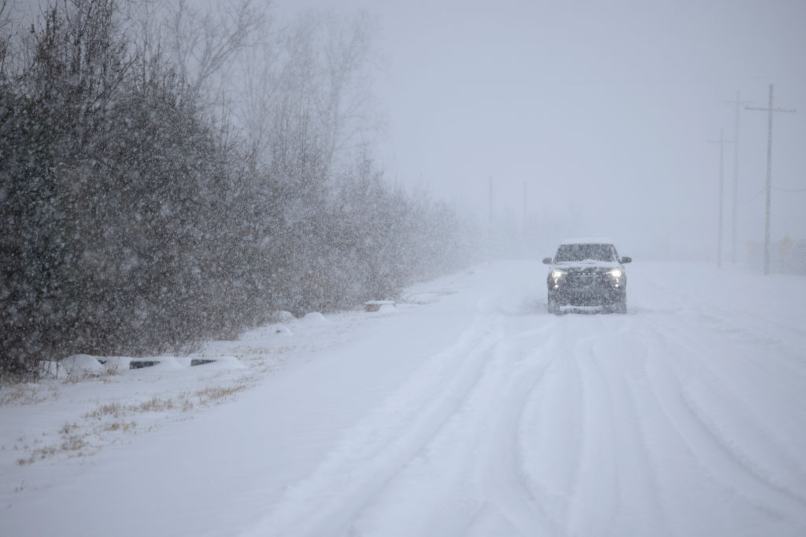
Heavy snow, ice, and strong, gusty winds are expected to affect 13 states across the U.S. with the National Weather Service (NWS) issuing winter storm warnings to the affected areas, which could see up to 15 inches of snowfall from Sunday night through Monday, and in some areas, even until Tuesday. Why It Matters File photo: A motorist drives through the snow near Louisville Muhammad Ali International Airport in Kentucky in January. A combination of accumulated snow, high winds, and ice is expected to create “hazardous conditions,” and the NWS is warning residents in affected counties that their morning and evening commutes could be affected, as blowing snow will reduce visibility, making many roads slippery, dangerous, and in some places, impassable. What To Know The following 13 states have been issued winter weather warnings: Tennessee, North Carolina, Virginia, Illinois, Indiana, Michigan, Pennsylvania, Ohio, New York, Kentucky, Wisconsin, Maryland, and Maine. In Tennessee, the Blount Smoky Mountains, Cocke Smoky Mountains, Sevier Smoky Mountains, Southeast Greene, and Unicoi Counties are likely to see up to 8 inches of snow, but areas near Mount LeConte and Newfound Gap could get between 10 and 15 inches, with wind gusts up to 40 mph, until Tuesday morning. From Monday afternoon through to Monday night, Upper Cumberland, Bledsoe, Campbell, Morgan, and Scott Counties could get up to an inch of accumulated snow, with areas above 1,500 ft seeing up to 2 inches. Portions of east Tennessee could get up to 3 inches (higher amounts are expected on the tallest ridges and peaks) by Tuesday morning. North Carolina North Carolina is likely to be hit with wintry weather until Tuesday morning. Swain County could get up to 2 inches of snow in the valleys, with 4 to 10 inches expected above 3,500 feet—over a foot is expected above 5,000 feet, in the Smokies. Winds over 45 mph could also lead to blowing snow, reduced visibility, and power outages. Ashe, Watauga, and Avery counties might see gusty winds reaching 45 mph and up to 4 inches of snow. Graham, Haywood, Madison, Mitchell, and Yancey counties are likely to get up to 3 inches in the valleys, 2 to 6 inches above 3,500 ft, and 10 inches on the highest peaks, along the Tennessee border. Parts of Northeast, Northern, and Southeast West Virginia, including Northwest Pocahontas, Southeast Randolph, Western Greenbrier, and Southeast Webster Counties, could get up to 8 inches of accumulated snow, with winds reaching 45 mph, causing reduced visibility until Tuesday morning. Ritchie, Wirt, and Putnam counties are likely to see up to 4 inches of snow by Tuesday morning, and Western Grant and Western Pendleton Counties up to 6 inches, with winds reaching 40 mph. Bland, Smyth, Tazewell, Mercer, Summers, and Grayson counties could see between 1 and 3 inches of snowfall by Tuesday with winds gusting between 40 and 45 mph. IllinoisMany parts of Illinois are expected to see Lake-effect snow, which is often localized, “with conditions varying from safe to dangerous across just a few miles.” Kankakee County could see lake-effect snow, with accumulations of up to 8 inches in the hardest hit areas (around 4 inches in other areas), with 1 to 2 inches of snow falling per hour, until noon on Monday. The NWS believes that the highest amounts of snow will be near and east of Interstate 57.Central Cook, Eastern Will, Northern Cook, and Southern Cook and Lake Counties could see intense lake-effect snow until Monday lunchtime, resulting in up to 10 inches in some areas, with around 8 inches expected near Lake Michigan. Snow rates could reach over 3 inches per hour, and winds of up to 30 mph are also expected to cause blowing and drifting snow, especially near the lake shoreline. The NWS has warned these counties that conditions “may temporarily cripple travel.” DuPage, Northern Will, and Southern Will counties could see similar conditions until around noon on Monday. Snow rates are likely to be slightly slower though, with around one inch falling per hour, with accumulations expected to reach up to 6 inches in the hardest hit areas, which are likely to be east of Interstate 355, especially toward Cook County.Benton, Iroquois, Ford, Jasper, and Newton counties could also get lake-effect snow, with accumulations reaching up to 5 inches by Monday evening.Champaign, Edgar, and Vermilion Counties might get between 2 to 3 inches of snow by Monday morning, with winds gusting as high as 35 mph. This has prompted the NWS to issue residents with the following warning: “If you are going outside, watch your first few steps taken on stairs, sidewalks, and driveways. These surfaces could be icy and slippery, increasing your risk of a fall and injury.” In Indiana, Lake and Porter Counties could see snow rates of around 3 inches per hour. Badly affected areas could get between 6 ...