Copyright standard
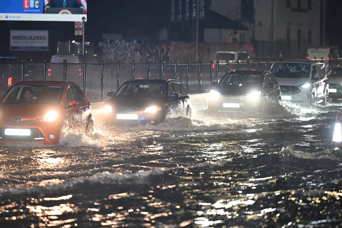
A new report has revealed the UK areas most at risk of flooding and several London regions are on the list. The research, conducted by insurance firm Aviva, found that estuary cities such as London, Liverpool, Cardiff and Bristol faced a double threat because rising seas amplify tidal surges and river flows peak more often. It also found that older, densely developed areas such as London could be hotspots for surface water flooding, because roads, driveways, pavements and buildings prevent rainwater from soaking into the ground. London was also identified as in “particularly acute” danger of subsidence, the sinking of the ground beneath a property. “Many cases of subsidence occur on clay-rich soils that expand when wet and shrink when dry. This natural ‘shrink-swell’ cycle can shift the ground beneath homes, roads, and critical infrastructure, weakening foundations and causing costly structural damage,” the report said. “The danger is particularly acute in regions where soil composition, building design, and weather patterns intersect and reinforce one another, for example, in London.” Jason Storah, CEO UK & Ireland General Insurance, Aviva, said: “In the UK we have seen the impacts of our changing climate and this year is no exception. Record temperatures, wildfires and flash flooding have affected lives across the globe and it is clear that action is needed to adapt to the increasing frequency of these events.” He added: “Millions more properties could be at risk from flooding, with rising temperatures, increased urbanisation and inadequate drainage exacerbating the risks in future.” “To make the UK climate-ready, we are calling for urgent, collective action to be taken to ensure we can mitigate the risks we will all face.” The report comes as the Commons environment audit committee was warned that Londoners’ lives and livelihoods are at risk from flash floods, following two extreme rainstorms in 2021. The MPs were told that the average cost of flooding to a home is £30,000. According to Aviva’s report, the region that is most at risk of flooding by 2050 in the UK is Bermondsey and Old Southwark, where 90.4 per cent of properties are in danger. The second most endangered London area on the list is Vauxhall and Camberwell Green, with 74.5 per cent of properties at risk. Next is Battersea, where 64.5 per cent of properties face flood damage. The report also highlighted two London landmarks at risk of climate change-related damage. The Red House in south London is already experiencing subsidence, because it is built on soil containing a high quantity of London Clay. The report flagged that the arts and crafts house was at risk of further damage. “This soil is highly susceptible to subsidence caused by shrink-swell movements as the ground becomes wet and dries out. This movement can cause foundations to shift, walls to crack and building instabilities to develop,” the report says. “Over the years, cracks have appeared both internally and externally, disturbing the beautiful facades of the building’s exterior and threatening some of the stunning murals within.” It added: “This picture is concerning, but also highly common across London, with its vulnerable soil and historic buildings. Much of the London population lives in homes that are more than 100 years old, and many homeowners will be familiar with the challenges faced by Red House.” Hampton Court Palace, once the home of Henry VIII, was also identified as endangered due to its riverside location. “By 2050, West London is projected to face wetter winters, heavier downpours, and rising river levels. These changes increase the risk of river flooding along the Thames, putting pressure on defences that were built for a different climate,” the report said. While the palace itself is protected by river walls and embankments, the 750-acre Home Park is at risk of flooding, as well as damage caused by heat stress and drought.