Copyright Newsweek
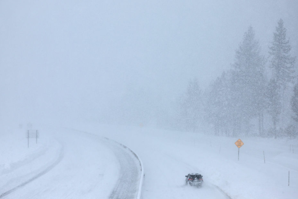
Winter weather alerts have been issued by the National Weather Service (NWS) for some parts of the Northwest through Tuesday, which warn of hazardous conditions involving up to 5 inches of snow. Why It Matters As winter sets in, residents and travelers in some Northwest regions have been urged to slow down, take extra caution when driving—especially on the morning commute—and expect “a few inconveniences to normal activities.” What To Know The following areas in the Northwest are likely to be impacted by snow, and the NWS has urged drivers to “plan on slippery road conditions.” Residents and travelers in the Central Panhandle Mountains, including the Lookout Pass and Dobson Pass, could see up to 5 inches of snow above 3,500 ft until early Tuesday morning. Those traveling from Eureka on Highway 93 to Whitefish and Highway 37 to Libby, or on Highway 56 to Bull Lake Road and Highway 2 from Kalispell to Libby, should expect to see wet snow (sleet) above 3,500 ft. But the NWS has warned that weather conditions might develop, bringing with it accumulated snow of up to 2 inches until around midday on Tuesday. The Marias Pass, Glacier National Park, Bad Rock Canyon, Polebridge, Essex, and Highway 83 from Bigfork to Swan Lake could also see developing weather conditions that might bring between 2 to 5 inches of snow, especially in areas above 4,500 ft, until noon on Tuesday. Polson, Flathead Lake, Flathead Valley, and Mission Valley are likely to see wet snow falling until midday on Tuesday, which may turn into accumulated snow, reaching around 1 inch. Highway 200 from Trout Creek to Heron, Evaro Hill, the I-90 Lookout Pass to Haugan, and Highway 200 from Thompson Falls to Plains might see wet snow developing into between 2 and 5 inches of accumulated snow in places above 4,000 ft, until Tuesday. Highway 83 from Seeley Lake to Condon, the I-90 from East Missoula to Bearmouth, and Highway 200 from Bonner to Greenough are likely to get sleet to start with, which could turn into around 2 inches of accumulated snow by midday on Tuesday. Authorities recommend residents and drivers take the following precautions if they have to travel: Prepare your vehicle with essentials such as blankets, food, water, and a flashlight in case you become stranded Dress in layers and limit outdoor exposure Monitor local updates and road conditions What People Are Saying The NWS has issued the following statement: “Winter traveling conditions. For MINOR winter weather impacts, expect a few inconveniences to normal activities. Use caution while driving. The hazardous conditions could impact the Tuesday morning commute, especially over higher passes.” What Happens Next The NWS recommends regularly checking local forecasts. Being prepared and staying alert to sudden changes in weather is the most effective way to protect against the worsening winter conditions.