Copyright rsvplive
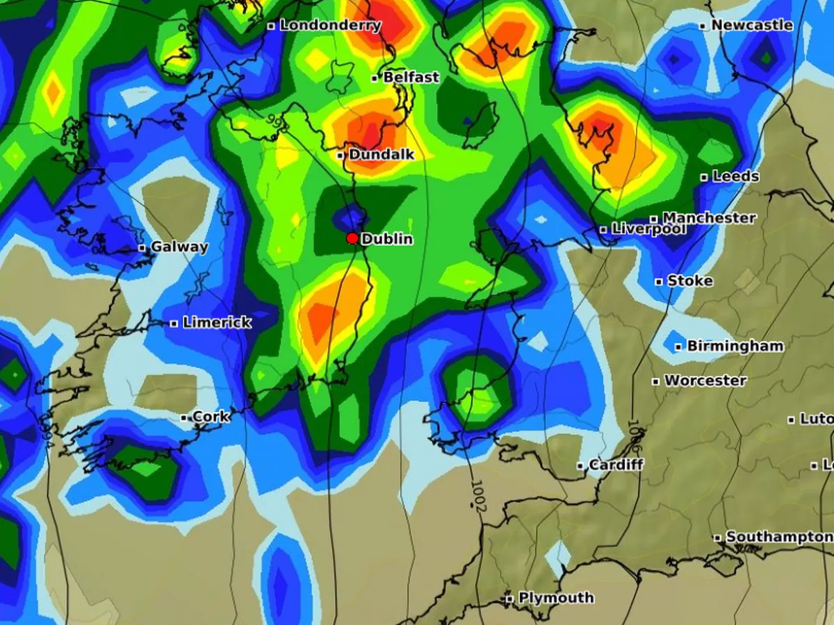
Met Eireann has given an update on when the “ remnants of Ex-Hurricane Melissa ” will hit Ireland. The national forecaster explained that a low pressure system will bring these remnants to the country. People should expect wetter conditions, with it also forecast to be “so warm” with moist air. Met Eireann stated that from Monday, 3 November to Sunday, 9 November, there are indications “for low pressure to the northwest dominating conditions”. They continued: “This low pressure system will bring remnants of Ex-Hurricane Melissa and so warm, moist air will bring milder but wetter conditions over Ireland this week. This will bring predominantly unsettled conditions with higher than average rainfall signalled across the country. “Mean air temperatures in week 1 will be mild with temperatures signalled to be above normal for the time of year.” There is currently a Status Yellow rain warning for Kerry, Clare, Galway and Mayo. It’s in effect from 8PM on Sunday, 2 November until 6PM on Monday, 3 November. It reads: “Persistent rain, turning heavy at times. Possible impacts: Localised flooding, difficult travel conditions and poor visibility”. Here is your weather forecast for the week ahead: Continuing dull and blustery with outbreaks of rain spreading from the west. The rain will slowly clear eastwards with drier and clearer conditions following into the northwest. Quite mild with highest temperatures of 13 to 16 degrees in fresh to strong and gusty southwest winds. Tonight, outbreaks of rain will continue in Munster and south Leinster, heavy in places with fresh southerly winds. Elsewhere will be drier with clear spells and isolated showers in light to moderate southerly winds. Lowest temperatures of 9 to 13 degrees. On Tuesday morning and afternoon, outbreaks of rain will spread northwards across the country. The rain will clear northeastwards to scattered showers in the evening. Highest temperatures 13 to 16 degrees in moderate to fresh southerly winds, easing later. Clear spells and showers at first on Tuesday night. It will turn cloudier overnight with scattered outbreaks of rain and drizzle spreading from the south. Lowest temperatures of 8 to 12 degrees, a little milder in the southeast, in light to moderate southeast winds. A wet day with widespread rain, heavy in some western areas. The rain will ease towards evening. Becoming breezier with southwest winds increasing moderate to fresh. Highest temperatures of 13 to 16 degrees. Remaining largely cloudy overnight with scattered patches of light rain and drizzle on Wednesday night. Lowest temperatures of 9 to 13 degrees in moderate to fresh southerly winds. A drier and brighter start to Thursday with sunny spells and just a few lingering patches of drizzle. Turning cloudier through the day with a spell of rain spreading from the Atlantic. Blustery in fresh south to southeast winds with highest temperatures of 11 to 14 degrees. Further outbreaks of rain are likely on Friday. Highest temperatures of 11 to 15 degrees in moderate to fresh southerly winds. There is uncertainty in the details of the forecast but current indications suggest that it will remain unsettled next weekend with Atlantic low pressure systems bringing further spells of rain.