Copyright Newsweek
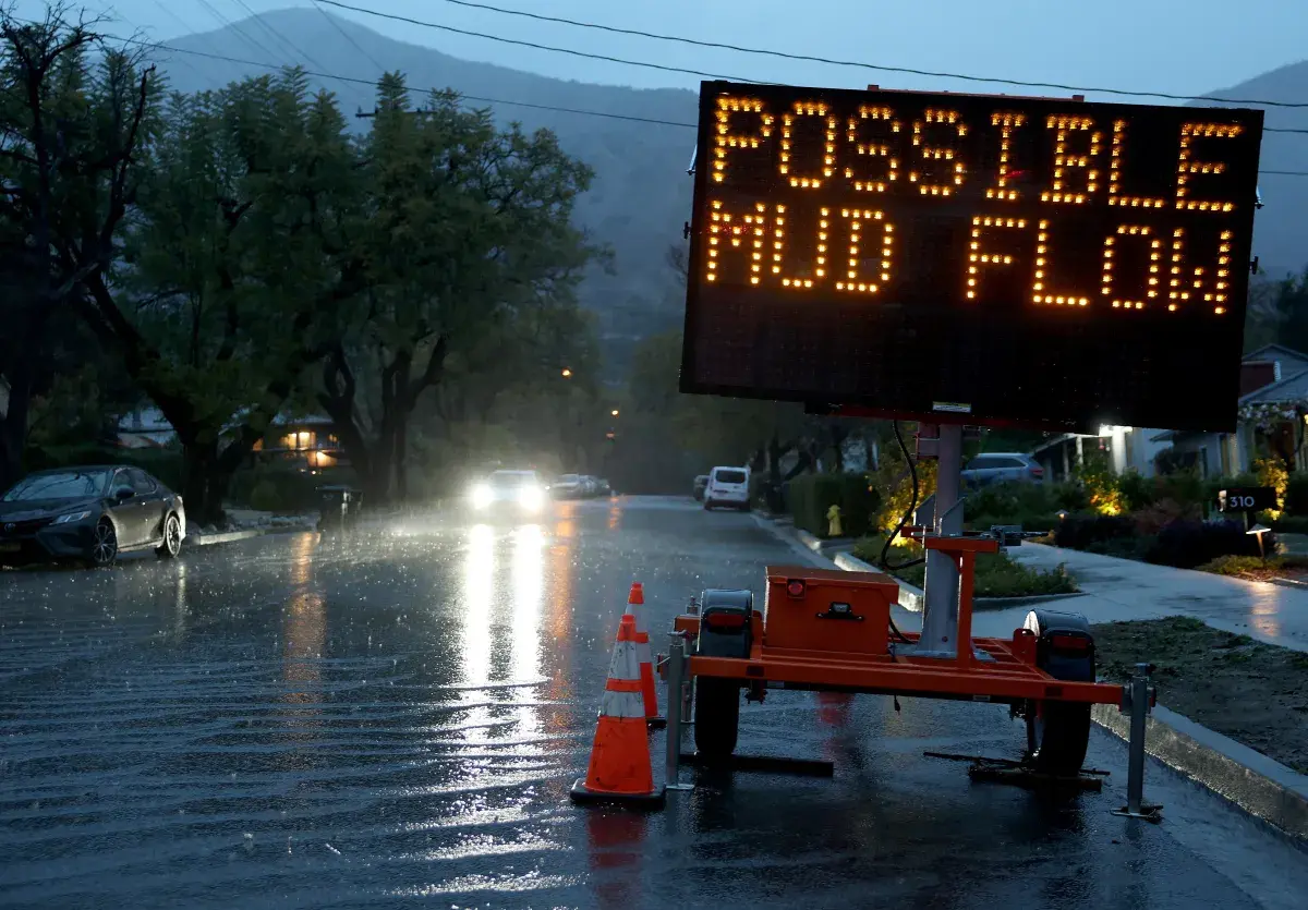
Severe weather warnings were issued across Northern and Central California on Tuesday as a strong atmospheric river unleashed heavy rain, damaging winds, and mountain snow. It is the first storm in a series that will produce more tumultuous weather across the Pacific Northwest later this week, AccuWeather senior meteorologist Heather Zehr told Newsweek. Why It Matters Atmospheric rivers are a "long, narrow region in the atmosphere—like rivers in the sky—that transport most of the water vapor outside of the tropics," according to the National Oceanic and Atmospheric Administration (NOAA). The storms brought by atmospheric rivers are known for their heavy snow, heavy rain and strong winds. They are more commonly found on the West Coast, particularly during the winter months. Although the storms can bring beneficial snow that helps supplement reservoirs throughout the summer dry season, they can also trigger deadly flooding, mudslides and widespread power outages. What To Know California's wet season typically begins in October, and the state has already experienced several storms as cooler weather sets in. National Weather Service (NWS) meteorologists warned that a strong atmospheric river would bring impacts to millions across the Golden State through Wednesday this week. As of Tuesday afternoon, myriad weather alerts and warnings were already in place. Among them are a flood watch, a high wind warning, a storm warning, and a coastal flood advisory, among others. The greatest threats will be flooding rain, heavy mountain snow, and strong winds. "A strong atmospheric river moving into northern California later today will bring a threat for moderate to heavy rainfall and flooding, gusty to high winds, and mountain snows for parts of the Northwest U.S. through Wednesday," the NWS said in a Tuesday forecast. High wind warnings in the area stated that wind gusts of up to 65 mph could blow down power lines. More than 8,000 people are without power in Northern California, according to data from poweroutage.us. "Damaging winds will blow down trees and power lines. Widespread power outages are expected," NWS San Francisco said in a high wind warning. "Widespread power outages are possible. Travel could be extremely difficult and hazardous, especially for high profile vehicles." What People Are Saying AccuWeather senior meteorologist Adam Douty said in a report: "Snow is expected to remain confined to elevations well above mountain passes with the first major storm into Wednesday night and much of the second storm later in the week. Much of this time, it will just rain to up around 8,000 feet or so." NWS in a Tuesday forecast: "Late this morning into Wednesday, a strong cyclone in the northeast Pacific reinforces the existing front and causes breezy to windy conditions to renew from northern California northward and brings the potential for heavier rains within the system's atmospheric river; isolated to widely scattered thunderstorms are anticipated." NWS San Francisco in a high wind warning: "Remain in the lower levels of your home during the windstorm, and avoid windows. Watch for falling debris and tree limbs. Use caution if you must drive. Winds this strong can make driving difficult, especially for high profile vehicles. Use extra caution." What Happens Next Weather alerts will remain in place until Wednesday. People in the affected areas should follow the advice of local weather officials and remain storm aware as the atmospheric river passes through.