Copyright WDIV ClickOnDetroit
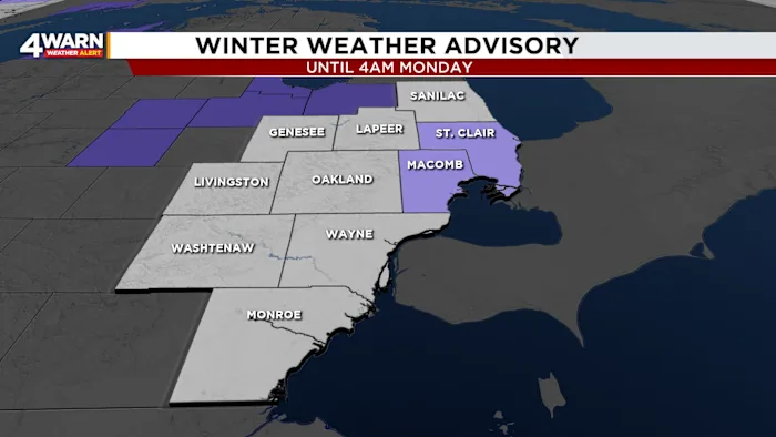
A Winter Weather Advisory is in effect for Macomb and St. Clair counties until 4 a.m. Monday as Southeast Michigan experiences its first days of snow this season. Northerly winds will leave communities downwind of Lake Huron seeing snow bands setting up. Light lake-effect snow showers are expected to bring total accumulations of about two to four inches in localized communities under the advisory. Outside of the advisory, Metro Detroit could see a dusting to an inch of snow by Monday morning. Any snow or freezing of wet roads could make for slick conditions during the morning commute. Drivers should plan for extra travel time Monday morning and dress warmly, as wind chills in the teens will make conditions feel even colder. Make sure sidewalks are salted, and have the kids bundle up for the first true taste of winter weather this season. Temperatures will drop into the lower- to mid-20s overnight, and wind chills will fall into the teens by early morning. Detroit will be a few degrees warmer, but still quite chilly. Monday will remain cold through the day with highs only reaching the lower- to mid-30s. There will be gradual clearing by the afternoon. For Tuesday, which is Veterans Day, expect mostly cloudy skies and highs in the upper-30s, with a gradual warm-up into the 40s and 50s for mid- to late week. Southeast Michigan’s first snow of the season arrived Sunday morning. Snowfall reports showed a range of totals across the region, with the highest amounts around two inches: Temperance (Monroe Co.): 2.3 inches Clinton (Lenawee Co.): 1.6 inches Ann Arbor (Washtenaw Co.): 1.5 inches Lapeer (Lapeer Co.): 1.5 inches Grand Blanc (Genesee Co.): 1.1 inches Romulus/DTW (Wayne Co.): 1.2 inches Saline (Washtenaw Co.): 1.2 inches Manchester (Washtenaw Co.): 1.0 inch