Copyright Chicago Tribune
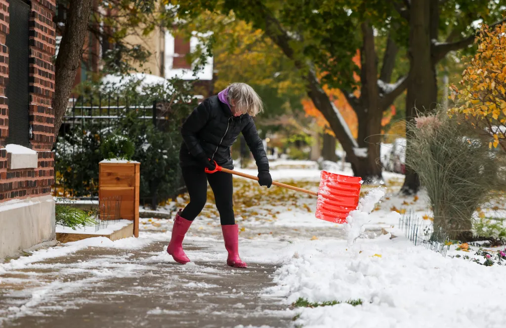
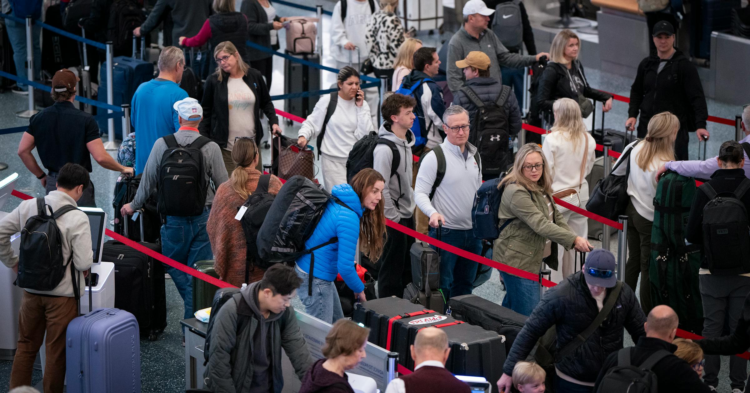
An unusually “impactful” lake effect snow — a phenomenon where warm lake water and cold air meet to form snow — landed overnight in the Chicago area with three to four inches of snow as residents woke up to the first signs of winter. Chicago got around two to four inches of snow late night and into Monday morning, while Lake County to Northwest Indiana got around five to 10 inches, according to the National Weather Service. Chicago was downgraded to a winter weather advisory that is expected to continue until noon today as temperatures are forecasted to be at a high of mid-30s and low of mid-20s with winds of up to 25 mph. More lake effect snow days are expected this winter until the lake freezes over, said Zachary Yack, meteorologist at the National Weather Service, as a “wetter” winter is expected, although not necessarily snowier. “It’s a bit of a toss up this year for what we’ll see,” said Yack. With total accumulated snow expected to reach one inch in the city, road travel along Interstate 57 is still considered hazardous with slick roads due to snow, according to the National Weather Service. Visibility could also be “down under a mile” in the center of the band, Yack said. “If you’re driving north to south across the city you could see those visibilities change quickly, just be prepared for that,” Yack said. He encouraged people to provide extra travel time. The city’s Department of Streets and Sanitation sent more than 250 salt spreaders in response to the winter storm last night and into Monday morning, with a large focus being on DuSable Lakeshore Drive and arterial routes to ensure they are “safe and passable,” according to a statement from the department. The city will continue to monitor the routes in preparation for another round of forecasted snow, according to Ryan Gage, director of public affairs at DSS which manages over 9,400 lane miles of roadways and has over 400,000 tons of salt piles stocked across the city. As the winter weather advisory continues today, residents should plan to stay off the roads, according to Chicago’s Office of Emergency Management & Communications X page Monday morning. Some public bus lines are also temporarily rerouted due to “severe weather conditions,” according to the Chicago Transit Authority website, including: #134 Stockton/LaSalle Express buses, #2 Hyde Park Express buses, #6 Jackson Park Express. According to the Chicago Transit Authority, rail and bus service is running normally. The conditions are “definitely not normal” for this early in the season, said Gino Izzi, senior meteorologist at the National Weather Service in Chicago. “It’s not really common that we get snowfall rates like we’re expecting with the lake-effect snow band,” Izzi said. “It’s pretty unusual. It sometimes happens once a year, once every two or three years.” Chicago weather: What’s normal for fall’s first freeze and first snow? And when does it happen? As cold air moves across the open, warm water of the Great Lakes, it picks up heat and moisture. Now less dense, the air then rises, cools and condenses into clouds, which produce heavy snow in narrow bands downwind. Some 15,000 to 20,000 feet up in the atmosphere, there is an unusually cold air front moving in. And Lake Michigan has been unusually warm, setting up the right conditions for lake-effect snow. The lake’s average surface water temperature in October hovered around 4½ degrees higher than the 30-year average of just over 57 degrees, according to data from the National Oceanic and Atmospheric Administration. That warmth continued into November. Last week, Lake Michigan’s surface water temperature was around 55 degrees, still several degrees above average. “You put that cold air over the top of such a warm lake, and it really leads to just explosive instability,” Izzi said. Air travel in Chicago will likely be further hampered by the storm, already severely disrupted by the government shutdown and an emergency order from the Federal Aviation Administration that canceled hundreds of flights at O’Hare International Airport and delayed another 1,000 on Sunday. As of Monday morning, there were a total of 536 delays and 294 cancellations at Chicago O’Hare International airport, according to FlightAware data. “This storm is bad news for travelers and will add even further misery to the current air travel challenges,” said Jonathan Porter, AccuWeather chief meteorologist, in a Sunday news release, noting that Monday’s heaviest band of snow may shift south of O’Hare around 5 a.m. and then south of Midway International Airport around 8 a.m. — resulting in the most impactful disruptions. The area saw its last snowfall in March, according to weather officials. Between 1991 and 2020, Chicago’s average yearly snowfall was 38.4 inches. But last winter, it only saw 17.6 inches of snow, according to AccuWeather. “The last couple of winters, we’ve had unusually low snowfall, so it’s not going to take much to surpass (that),” Izzi said. “And there’s even potential for above-average snowfall, which would be considerably more than what we had the last couple winters.”