UM research flight captures the shape of ice storm damage, predicts climate change disturbance
EMMET COUNTY, MI — Hovering more than 3,000 feet above the ground, researchers flew low and steady to get a better picture of the destruction caused in Northern Michigan from the spring ice storm.
Researchers headquartered at University of Michigan’s Biological Station in Emmet County set out over the summer to capture aerial surveys of 10,000 acres of forest around the Pellston Airport.
Data collected from both the soil and canopy will give insights into the changes in forest structure over time, predict vulnerabilities to climate change and potentially inform future forest management.
From the plane, a sophisticated sensor system shot down lasers that bounced off trees reporting back data like the height of trees and the gaps between them.
The data from the sky and ground will create a three-dimensional map to help assess which areas were hit the hardest, said Iris Kennedy, a graduate student researcher from the University of Connecticut who is running the field crew at UMBS for the project.
The team is looking to answer the question: How does the shape of the forest affect the function of the forest?
“Research shows that they’re very closely tied together, so measuring that structure is really important understanding long term what is going to happen to this forest,” she said.
This 2025 project is funded by the National Science Foundation through a RAPID grant, which is designed to assess the impacts of natural disasters.
In particular, this funding aims to “unravel consequences of disturbance interactions in forests, which are increasing as a result of climate change.”
While working to predict future impacts of climate change, the team flew through hazy skies produced by Canadian wildfires that raged through August under hot, dry conditions.
“It’s definitely not lost on me that I spent the whole summer looking at the AQI [air quality index] every time I went outside,” said Bob Fahey, who has been working on forest research at UMBS for 15 years.
Predicting future climate change disturbances is heavily informed by the past.
Fahey’s team is using comparable findings from a 1998 ice storm in New Hampshire and Quebec, Canada as well as experimental ice storms where firetrucks hosed down forests at different freezing levels for researchers to record how forests responded.
Going back to the 19th century, Fahey notes that Michigan’s great fires were predated by strong wind storms that brought down brush.
Storm debris, coupled with droughts and an aging forest, is adding up to a concerning outlook for Northern Michigan forests.
“Now there’s a huge influx of potential wildfire fuel that just got added to the ground layer of all the forests,” Fahey said. “I think fire is more likely to be an issue in the northeastern U.S. than it has been in the last hundred years.”
Future planning: Management of 4M acres of Michigan state forest delayed by ice storm damage
Gathering data now could potentially inform forest management in the future, Fahey said.
For instance, ice storm data points could advise what trees should be cleared or should not be replanted near homes, power lines and other infrastructure.
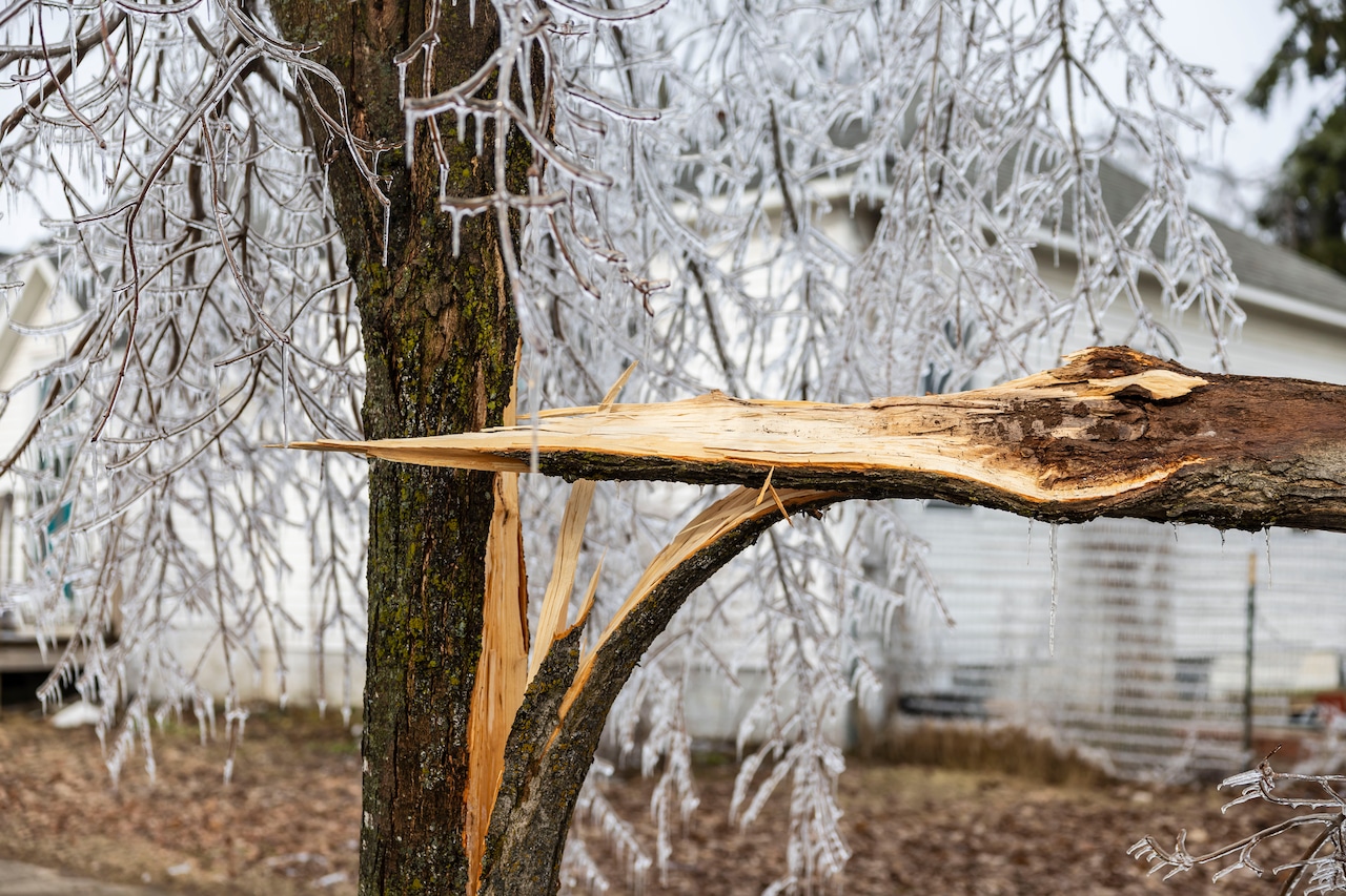
Early observations showed pines broke off and fell down whereas entire aspen trees went tip up and crashed down. Maples and birch trees, however, just bent over and sometimes popped back up.
The estimated 1 million acres of disrupted land in Northern Michigan is in its initial phase of resistance. It’ll likely be at least 3-5 years before researchers can track a resilience phase.
Forest studies are, by nature, longitudinal because of trees’ long reaction and recovery periods.
The Biological Station has been studying Northern Michigan forests since the lab’s inception in 1909. The most recent aerial survey was 2019, so there’s a significant baseline of data to compare from pre-ice storm.
The station has an ongoing study called the Forest Resilience Threshold Experiment measuring carbon cycling after a disturbance.
One reoccurring pattern is that disturbed forests with canopy gaps had growth periods as younger trees got an opportunity for more sunlight.
Fahey expects preliminary results on forest patterns within the year but results on how the forest will respond will come further down the line.
The project funding extends until the summer of 2026.