By Mark Page
Copyright grimsbytelegraph
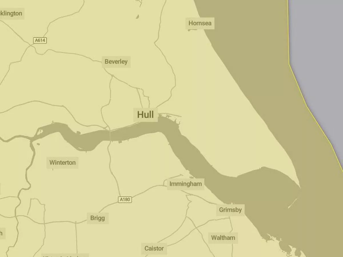
Windy weather has arrived in northern Lincolnshire with a yellow-level warning in force until 6pm today. However, the wait will continue for the first named storm of the 2025/26 season which will be called Amy when it arrives. As reported, the Met Office issued a weather warning for much of England and Wales late last week stating “strong and gusty winds are likely to cause some disruption to travel and interruptions to power”. It came into effect at 8pm on Sunday with the winds expected to peak in our region on Monday afternoon. Some travel restrictions are in place in the region, including the Humber Bridge being closed to high-sided and wind-vulnerable vehicles. Meanwhile, spells of rain are forecast, particularly later in the afternoon and into the evening. Temperatures will peak at around 17-18C though it’ll feel quite a bit cooler in the wind. It will stay windy overnight tonight but less so than during the day. Looking ahead, it’s set to stay fairly unsettled over the coming days though some brighter conditions are forecast on Tuesday and it will be “feeling warmer” as winds ease. More wet and windy weather is expected midweek but it should be drier on Thursday and Friday though further showers are likely at times. Temperatures will be around average but could climb above 20C at times, particularly later in the week before cooling down at the weekend. Though there has been a lot of coverage elsewhere discussing this wet and windy weather as Storm Amy, it hasn’t actually been named by the Met Office, Irish forecaster Met Éireann or KNMI, the Royal Netherlands Meteorological Institute and it is not expected to be. For today’s weather, Met Office meteorologist Tom Morgan said there is expected to be “low impacts in general” but it will be “a windy and pretty unsettled start to the week with a mixture of sunny spells and heavy blustery showers”. Why these stormy conditions have not been named is due to their anticipated lower impact than what would qualify as a named storm. The Met Office website states: “In the UK a storm will be named when it has the potential to cause disruption or damage which could result in an amber or red warning. This is based on our National Severe Weather Warnings service, which is a combination of both the impact the weather may have, and the likelihood of those impacts occurring. “Storms will usually be named on the basis of the impacts from strong winds, but the impacts of other weather types will also be considered. For example rain, if its impact could lead to flooding as advised by the Environment Agency, SEPA and Natural Resources Wales flood warnings, or snow. Therefore ‘storm systems’ could be named on the basis of impacts from the wind but also include the impacts of rain and snow.” When this happens, a storm will be named from the year’s list. The 2025/26 season will begin with Amy and be followed by Bram, Chandra, Dave, Eddie and Fionnuala. The full list is on the Met Office website. Get all the latest headlines sent straight to your inbox for free with our newsletter. You can stay up to date with all the breaking news and top stories in our area as they happen by clicking this link.