Copyright theorkneynews
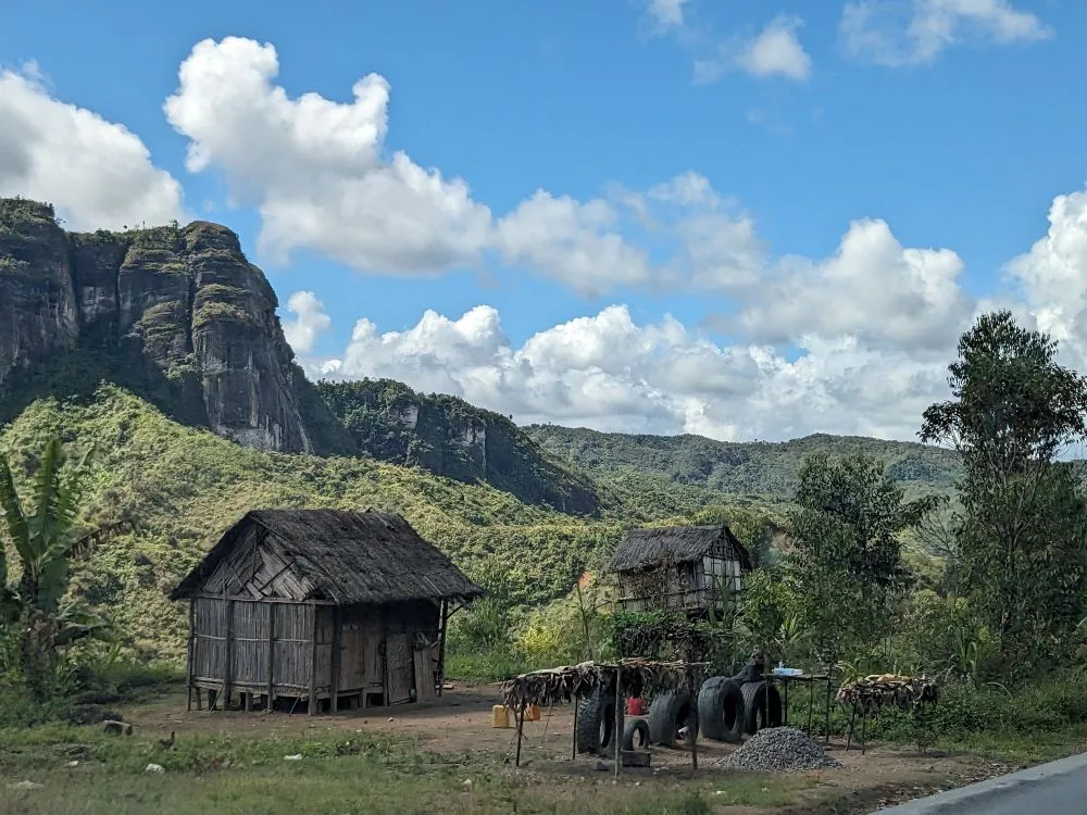
Two great rifting events, separated by nearly 80 million year, first tore what was to become the island of Madagascar from Africa, then from India, tilting and reshaping its terrain and setting the stage for life to flourish in isolation. Madagascar first separated from Africa about 170 million years ago, forming a rugged western escarpment and an eastward-tilted plateau. For tens of millions of years, its rivers drained mainly eastward across this landscape. But around 90 million years ago, a second rift opened on the island’s eastern side, separating Madagascar from India and the Seychelles. The crust thinned again — but this time the island tilted in the opposite direction, toward the west. The consequences were dramatic: rivers reversed course, the island’s main water divide shifted eastward, and a new, steep escarpment formed along the Indian Ocean margin. Romano Clementucci from ETH Zurich explained: “When the island tilted after each rifting event, the main water divide, the line separating rivers flowing east or west, jumped across the island, transforming its hydrology and erosion patterns.” Over time, the western escarpment evolved into a worn-down landscape of remnant highlands and low-relief plateaus, while the east developed a young, linear, and steep escarpment – today’s most recognizable feature of Madagascar. Over 90% of Madagascar’s mammals and reptiles and more than 80% of its plants exist nowhere else on Earth. Researchers have long attributed this extraordinary biological richness to climate and isolation from the continents. But recent studies are contributing towards a deeper geological dimension to the story. Two hundred years ago Alexander von Humboldt proposed a unified theory for understanding biodiversity patterns. A new study by Clementucci and colleagues contributes to this theory by extending biodiversity drivers from classic climatic hypotheses to erosion process. Clementucci said: “We show how ancient tectonic forces reshaped Madagascar’s surface, tilting the island and shifting the main rivers and mountain divides. Over millions of years, this created fragmented environments where species evolved independently, especially along the island’s dramatic eastern escarpment.” The broader implication is a shift in how we view so-called “stable” regions such as Madagascar, South Africa, India, Brazil, or Australia and other passive margins. These areas are often seen as geologically quiet, yet they host some of the planet’s richest biodiversity. Click on this link to access, Madagascar’s landscape evolution: A tale of two rifts, published in Science Advances.