Copyright telanganatoday
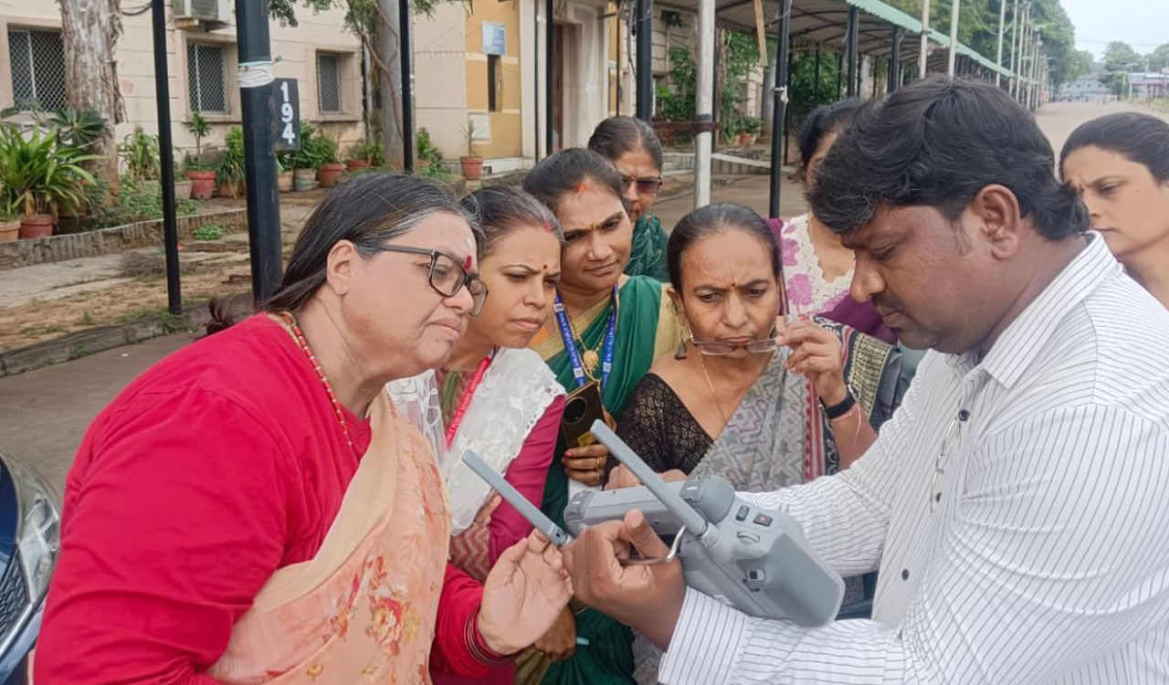
Hyderabad: GeoMap Society (GEMS) as a prelude to the GeoMap Quiz of 2025, organized a GEOTOP (GeoTeachers Orientation Programme) which which brought together approximately 30 Geography and Social studies teachers from various schools for a GIS and mapping workshop. Maj Shiva Kiran, President GeoMap Society made a presentation on GIS/ mapping applications, highlighting their relevance in urban development, healthcare, and other key sectors. Additionally, PS Rayudu conducted a live demonstration of drone-based GIS mapping. For the teachers, it was their first hands-on experience with drone mapping, offering valuable insights into its nuances. Flying at an altitude of 30 metres, the drone successfully mapped the entire 22-acre exhibition area in just 15 minutes. The GeoMap Quiz 2025 brochure was unveiled during the event. The preliminary round is scheduled to coincide with the International GIS day celebrations on November 19, themed “Geo-Generalist Era: Where Spatial Meets Everything”. M Chandrashekar, Secretary, KNEC, Dr D Gangadhar Rao, President Economic Committee, BN Rajeshwar , Secretary Exhibition Society and R Sukesh Reddy, Vice President Exhibition Society and other dignitaries addressed the gathering.