Copyright wsvn
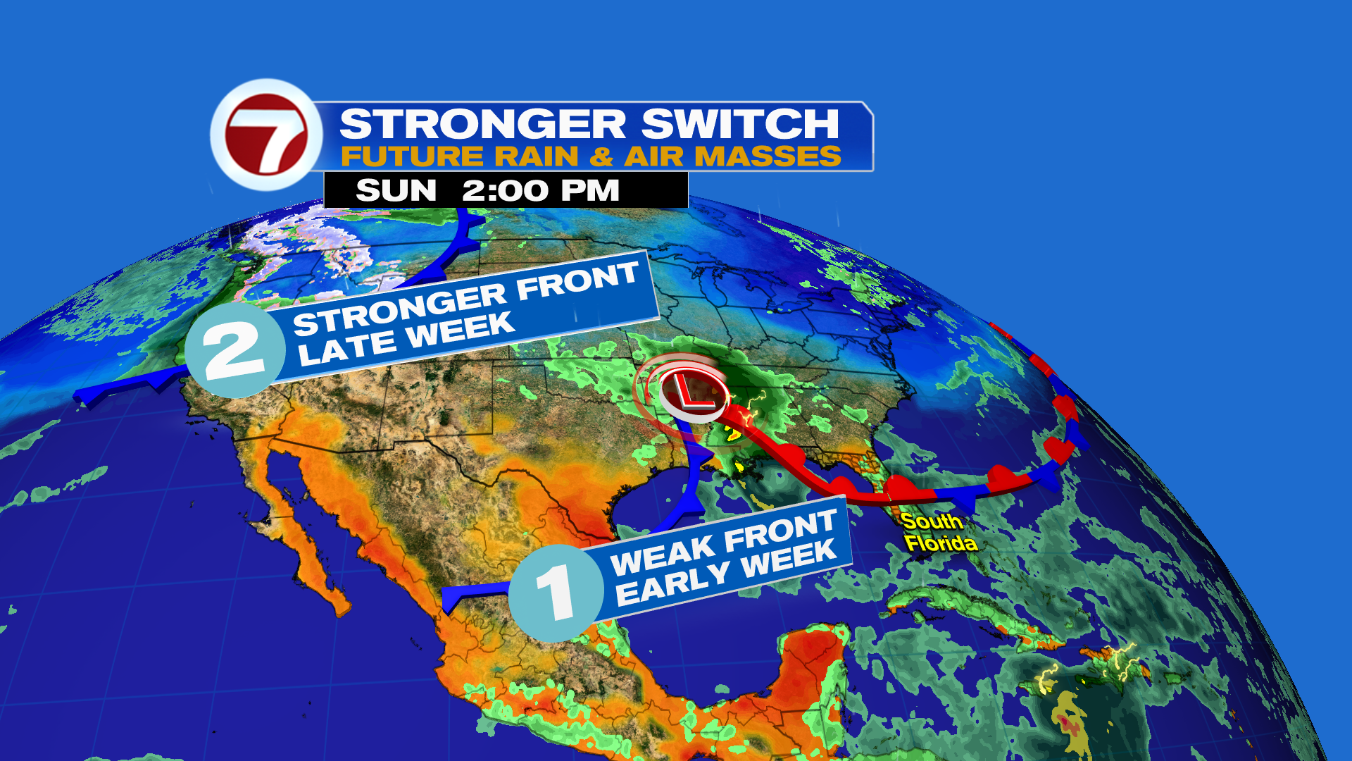
We’re getting to that time of the year when South Florida experiences more variations and changes to the weather pattern as several fronts are set to cross through the region this week. The first front arrives Monday night into Tuesday with dropping humidity followed by the second, stronger front sweeping through on Thursday, which will usher in a notable drop in temperatures. These fronts will also keep Hurricane Melissa away from the US by at the coast of Cuba, the Bahamas and Turks and Caicos. More on Melissa’s forecast below. For our Sunday in South Florida, it will be fairly similar as what we saw yesterday: times of sunshine, more cloud cover and anytime, quick-passing showers riding that breeze. It won’t be rainy all day long but it certainly will be wet at times. Otherwise, temperatures will be warm and it will feel more humid. The breeze will also be slightly less intense compared to Saturday with sustained winds at 15-25 mph and gusts up to 35 mph out from the east. Then on Monday, that aforementioned front will approach, and this will allow for scattered showers and storms to develop during the afternoon hours. Some of this rain could be heavy. Behind the front will be dropping humidity but it won’t be a dramatic change. Tuesday will still be warm and humid with sunshine and the potential for morning fog. Most areas should be dry by then. Wednesday is when humidity should be lower. It’s not until Thursday when the stronger front arrives, leading to sunshine, mostly dry conditions and very comfortable temperatures. Highs late in the week will be near 80F while lows will be in the 60s! Will be great for Halloween on Friday! Tropical update Hurricane Melissa has rapidly intensified since Saturday, reaching Category 4 status as of 5AM Sunday. It is likely to continue strengthening, reaching Category 5 status later in the day Sunday into Sunday night. It will then slowly turn toward the northeast by Tuesday, which is when it is becoming increasingly likely it makes landfall on the southern coast of Jamaica as a strong Category 4 hurricane. Beyond then, it is expected to make a second landfall in eastern Cuba late Tuesday as a Category 4 hurricane. On Wednesday into Wednesday night, Melissa will track across the southeastern Bahamas and near Turks and Caicos — still as a major hurricane — while speeding up in forward movement. In addition to the very strong winds, Melissa’s other main threat will be heavy rainfall that will lead to catastrophic flooding and mudslides for parts of Jamaica and Haiti these next few days. Isolated totals of around 40 inches will be possible.