Copyright bbc
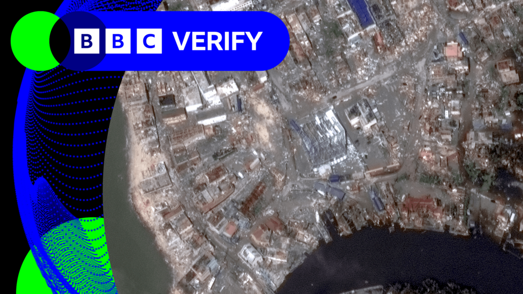
Thomas CopelandBBC Verify Live journalist This morning I’ve been reviewing the latest satellite imagery from Jamaica which reveals the scale of devastation left behind by Hurricane Melissa, which killed four people as it ripped across the island yesterday. The town of Black River on the island’s south-west coast "has literally been totally destroyed" by the category five storm, Jamaica's PM Andrew Holness told the BBC. In these side-by-side comparisons of satellite pictures from before and after Melissa struck we can see the impact right where the Black River flows into the Caribbean. In this first wider view it’s clear most of the buildings in the town have been heavily damaged and there’s debris lining every street. In the bottom right you can see that the Black River has burst its banks and along the waterline sediment runoff has left a brown strip of muddy water. When we zoom in closer to the town centre we can identify specific buildings. The large white building in the middle is the Black River Market - its roof has been ripped clean off. The same has happened to the orange roof of a warehouse at the top right. The fire station to the right of the market in this picture appears to be still standing but badly damaged. Most other buildings here in the town centre are in far worse shape.