Copyright independent
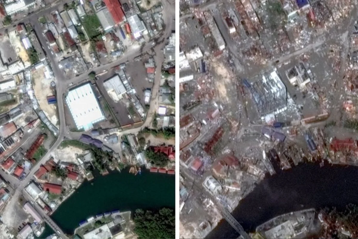
Satellite imagery in Jamaica shows the extent of flooding left behind after Hurricane Melissa roared ashore. The storm barrelled through the northern Caribbean on Wednesday (29 October) after thrashing Cuba's second-biggest city and unleashing devastation in Jamaica. At least 34 people have died across Jamaica, Cuba, and Haiti. Hurricane Melissa began as a category 5 storm and has now weakened to category 2, moving across the Bahamas. It is expected to pass near Bermuda. Emergency relief flights have begun landing at Jamaica’s main international airport, which reopened late on Wednesday. Crews are now distributing water, food, and other basic supplies to those in need.