Copyright cleveland.com
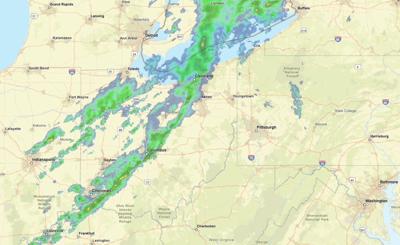
CLEVELAND, Ohio — A fast-moving cold front is bringing a round of rain and gusty winds to Northeast Ohio Friday, the leading edge of a major pattern change that will usher in colder air and even the first snowflakes of the season by early next week. Showers and embedded downpours will move west to east through late morning and early afternoon before tapering off by evening, according to the National Weather Service in Cleveland. Most areas can expect about a quarter to a third of an inch of rain. Winds will blow out of the southwest at 15 to 20 mph, gusting at times near 30 mph before easing late in the day as the front pushes east of the region. By kickoff for Friday night’s high school football regional quarterfinals, conditions should be mainly dry, though skies will stay mostly cloudy with temperatures in the low to mid 50s and a lingering breeze from the west. Behind the system, cooler air will settle in overnight and into Saturday. Overnight lows will be around 40 degrees for most of the region, with a few inland spots dipping into the upper 30s. Skies will remain mostly cloudy Saturday with highs in the low 50s. A few spotty showers could linger, but much of the day will be dry. Wintry weather by the end of the weekend Another, stronger storm system will take shape Sunday, ushering in the coldest air of the season so far. Rain will return during the day and is expected to mix with — and eventually change to — snow by Sunday night, as temperatures tumble throughout the day into the 30s. Lake-effect snow bands are likely to develop late Sunday night into Monday morning, with several inches possible in the primary snowbelt east of Cleveland and lighter coatings elsewhere, forecasters said. Any locations where the lake-effect snow settles could end up with a few inches of accumulating snow — especially Monday evening and night when the sun goes down. While this won’t be a blockbuster snow by any means, it will be the first of the season, which can create more travel headaches than similar systems later in winter when drivers are more accustomed to slick conditions. The lake-effect snow showers will gradually shift east and taper off through Monday night as the system exits and high pressure builds in from the west. By Tuesday, skies should begin to clear with highs rebounding into the 40s — a modest but welcome warmup after the first true taste of winter.