The morning commute will see mostly cloudy to overcast skies with patchy fog. Showers begin working into Greater Boston, so snag the umbrella on your way out the door. More widespread, heavier rain arrives in the afternoon across all of New England, so you can expect a soggy commute home. An isolated severe thunderstorm or two are possible in the afternoon and evening.
Highs will reach the upper 60s and low 70s across New England. Greater Boston will likely reach the low 70s with some help from a decent southerly flow drawing warm and moist air into the region.
Scattered showers will linger through the night as temps fall into the low 60s for most under cloudy skies.
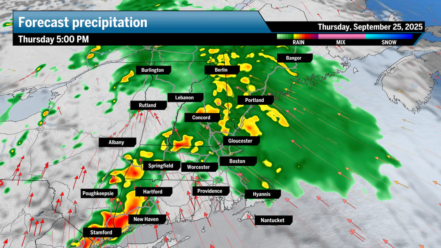
A fresh, potent storm enters the picture on Thursday morning as a surface low-pressure system delivers rounds of showers to steady and even heavy rain at times. The core of the storm passes to the north of New England, but a leading warm front followed by a strong cold front will spur rounds of wet weather with the chance for heavy rainfall at times and an isolated severe thunderstorm.
A steep southerly flow ahead of the system will pump moist air into the region. This will do three things: provide plenty of precipitable water, drive dew points to the upper 60s, leading to muggy air and low-hanging clouds, and keep our air temperature likely in the low 70s.
Winds will build to 10 to 15 miles per hour since the ocean has little friction, allowing for winds to really pick up. Boston, Worcester, Providence, the Cape, and even Springfield will notice the increasing breeze.
There is a slight chance for some of these storm cells to turn severe, and most of Southern New England will be under an environment that may produce a few strong downdrafts, leading to a handful of strong wind gusts.
Between the morning and afternoon/evening rounds of rainfall, the heaviest rain may fall across southwest New England. Storms may repeat over the same areas with some heavy shots of intense rainfall, leading to an isolated risk for flash flooding. It also doesn’t help that the ground is firm and brittle from drought conditions over the last two months.
I can easily see rainfall totals reaching over an inch across most of Southern New England, even pushing north, as well. A few spots may end up with 2- to 3-inch rainfall totals by midnight.
Greater Boston: Cloudy, patchy morning fog, and rounds of rain starting in the morning. Highs to the upper 60s along the north and south shores, low 70s within city limits. Breeze between 10 and 15 mph.
Southeastern Mass.: Overcast, patchy morning fog. Showers starting in the morning, steady rain in the afternoon and evening. Highs to the upper 60s, low 70s. Breeze between 10 and 15 mph.
Central/Western Mass.: Cloudy, patchy fog, scattered showers when you wake up, with bouts of rain throughout the day. Highs in the upper 60s in the Berkshires, low 70s elsewhere.
Cape and Islands: Cloudy with patchy fog and a breeze to 15 miles per hour. Scattered showers begin by mid-morning and last throughout the day. Highs to the upper 60s and low 70s.
Rhode Island: Cloudy with scattered showers turning to rounds of steady to heavy rain. Highs to the low 70s.
New Hampshire: Mostly cloudy with patchy fog. Highs to the upper 60s and low 70s with rounds of showers and rain.
Vermont/Maine: Mostly cloudy to overcast with rounds of rain working across both states throughout the day, mostly after the morning commute in Maine, earlier in Vermont. Highs to the upper 60s in both states.
Sign up here for our daily Globe Weather Forecast, which will arrive straight into your inbox bright and early each weekday morning.