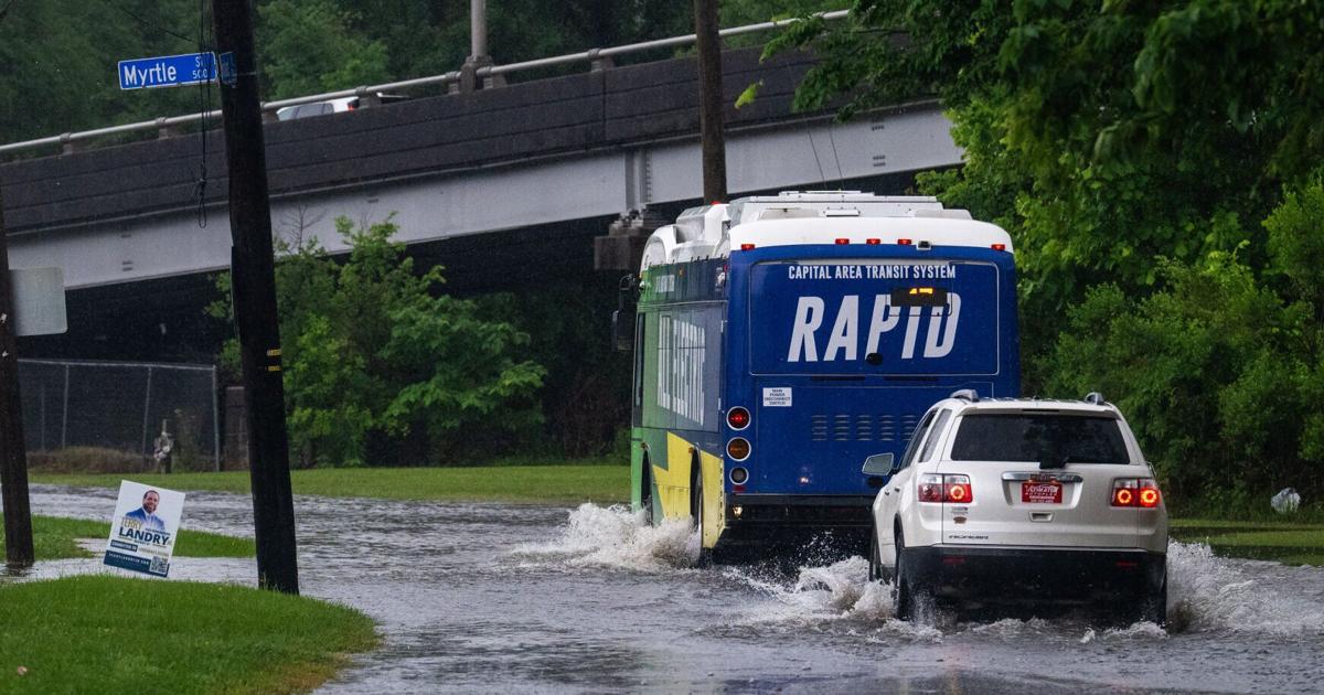
When a storm is barreling in from the Gulf, which neighborhoods would be most likely to flood and at what depths? And can that be predicted quickly with affordable technology?
A team of LSU scientists are using artificial intelligence to do just that — and are so far having success. They are developing a new flood prediction technique that runs exponentially faster than previous models while yielding highly accurate results.
The method documents both storm surge and inland flooding from rainfall. Z. George Xue, a professor in the department of oceanography and coastal science and the Center for Computation and Technology, said the new method could assist disaster managers during storms and help analyze longer term risk patterns.
The results of six years of research were published in July in the journal Natural Hazards. The team of professors, post-doctoral students and graduate students received federal support from the National Oceanic and Atmospheric Society, the U.S. Geological Survey and NASA for the project.
The new system offers “a promising strategy to overcome the trade-off between speed and accuracy in flood predictions,” the paper states, by combining two types of methods: a slower but more accurate model, and a faster AI model with lower accuracy.
This hybrid method relies on the accurate, but computationally intensive, models that Xue’s team previously created. The result, called the Prediction-to-Map, is flooding predictions that are 100,000 faster than the previous models, Xue said.
“You can imagine if each of the simulations use 500 computers running for one hour, then nobody can afford that,” Xue said. “But if you use the AI model, that’s one laptop for four seconds. We migrate that into a supercomputer and we can generate tens of thousands of scenarios.”
The study drives home the point that fast and affordable flood models are becoming increasingly important for local officials.
“As global exposure to floods is projected to rise, the demand for rapid and accurate flood prediction becomes crucial for effective decision-making and risk mitigation,” it says.
Hurricane Nicholas predictions
The scientists used 2021’s Hurricane Nicholas, a Category 1 storm that hit the Houston area, to test the accuracy of their models. The AI prediction method used the expensive data from the LSU team’s past numerical models, as well as “real data,” Xue said, such as river gauges and buoys.
More specifically, the scientists created one AI model trained exclusively on the real data to predict flood depths at certain points. Another AI model trained on the team’s previous numerical model was used to map flood depths at the same points.
As the researchers had hoped, the novel prediction method corresponded to the actual flooding of the storm near Galveston Bay. In fact, it was more accurate than the existing model.
This new hybrid model has only been done on greater Houston, but the intensive numerical models have been run for the Louisiana and Texas Gulf Coasts.
“For the longer term, we plan to adapt this AI model into the entire Gulf Coast, but that depends on what kind of resources we have,” Xue said.
In addition to expanding the coverage area, the LSU team eventually wants to “downscale” the project, which means zooming into a hyperlocal area — like a single street or neighborhood — to predict flooding during an extreme weather event. Gathering this information is “totally different” than regional modeling, Xue said, and requires more data and different algorithms, among other information.
This is one avenue where the technical modelers may collaborate with social scientists to help Gulf Coast communities during storms, explained Jim Spencer, a professor of architecture and urban planning at LSU who is working with Xue on a separate Gulf Coast resilience project.