Copyright axios
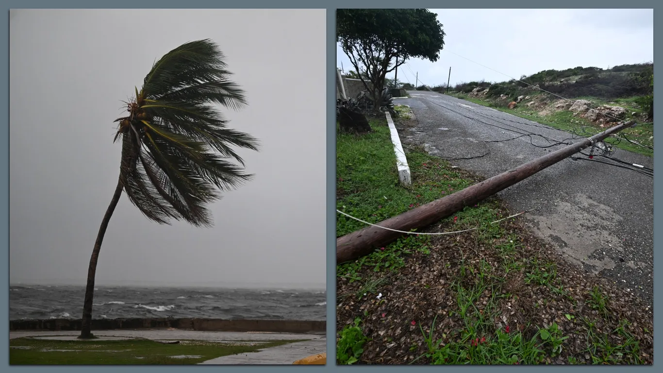
Threat level: "Additional intensification is forecast over the next day or so, followed by fluctuations in intensity," the National Hurricane Center warned in a Sunday evening forecast discussion. It's "expected to be a powerful major hurricane when making landfall in Jamaica" Monday night or Tuesday morning and southeastern Cuba late Tuesday."It now appears virtually certain that the core of a powerful hurricane will move over Jamaica Monday and Tuesday," said NHC deputy director Jamie Rhome in an online video. "With it will come long duration, destructive winds, catastrophic flooding, loss of power, loss of communication and communities will be cut off for several days in the aftermath," he said. "All preparation to protect life and property should be rushed to completion."The storm is expected to bring "life-threatening" flash flooding and landslides to other parts of the Caribbean, including southern Hispaniola and Cuba, according to the NHC. By the numbers: The hurricane is expected to bring rainfall of 15-30 inches to portions of Jamaica and 8-16 inches to southern Hispaniola through Wednesday, with the NHC warning that local storm total maxima of 40 inches is possible. Situation report: Hurricane Melissa was stalled some 115 miles south-southwest of Kingston, Jamaica, at 8pm Sunday ET, according to an NHC forecast discussion three hours after the previous one locating the storm in the same place. Its maximum sustained winds remained at 145 mph as it headed west with a movement of 5 mph.Residents across Jamaica reported starting to feel the effects of the storm on Sunday evening amid wet and windy conditions. Background: Melissa became a tropical storm over the Caribbean on Oct. 21 before undergoing rapid intensification over the weekend. Its maximum sustained winds increased from 70 mph at 11am Saturday to 140 mph by 5am Sunday. Between the lines: Melissa gained strength at a time when sea surface temperatures across the Caribbean were "among the warmest on record for the date, apart from the record-warm years of 2023 and 2024," per Yale's Climate Connections. "The odds of such unusual warmth have been boosted at least 500-fold by human-caused climate change," Climate Connections noted, citing Climate Central's Climate Shift Index.Melissa is the fourth storm this year to increase by at least 50 knots in 24 hours, after hurricanes Gabrielle, Humberto and Erin, meteorologist Kieran Bhatia noted on X.That means 2025 "is tied with 2020, 2005, and 2008 with the most 50+ knot rapid intensification events in a year," he added. Scenes from Jamaica as hurricane closes in Go deeper: Study: Hurricanes intensifying faster near coastlines amid warming Editor's note: This is a breaking news story. Please check back for updates.