Copyright expressandstar
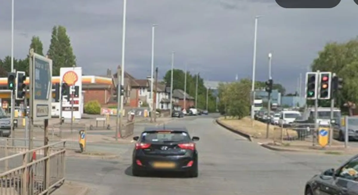
Wolverhampton Council has submitted a planning application to build a new circular road system at the junction between Willenhall Road and Neachells Lane as part of a wider scheme to improve access from the east of the city. But the proposals will see the demolition of two privately occupied houses in Neachells Lane, and the gardens of a number of other houses will be cut short to make way for a new link road. A neighbouring petrol station has also lodged an objection, saying it will be detrimental to business. The Neachells Lane junction improvements form part of the wider City East Gateway project, which aims to improve traffic flow on the corridor linking Wolverhampton with Walsall, the Black Country Route, M6 and regeneration areas including Canalside and East Park. The proposals will be considered at a meeting of the planning committee on Tuesday. Following public consultation, the council has come up with a preferred scheme which will see the construction of a northbound slip road from Willenhall Road to Neachells Lane. A new link road will be built between the existing Shell petrol station and Travis Perkins depot, for traffic turning left out of Neachells Lane onto Willenhall Road. The council said that while it would still need to acquire some land for scheme, the main construction project was expected to start in 2031. Councillor Qaiser Azeem, Cabinet Member for City Transport at City of Wolverhampton Council, said: “This is a transformative project along one of Wolverhampton’s most important transport corridors. It will help unlock growth, improve journey reliability, and support safer, greener travel for residents, businesses and visitors.” The scheme will also see the realignment of the Walsall-bound carriageway along Willenhall Road, and dedicated access and parking for some residential properties on Willenhall Road. There will be improved cycle routes and footpaths, as well as tree planting and improved surfacing, says the council. It will follow phases one and two of the A454 City East Gateway scheme, from Bilston Street Island through Middle Cross and Lower Horseley Fields, up to the Chillington Fields junction. These parts of the scheme, which also incorporate Walsall Street and Lower Walsall Street, have been approved in principle, with work slated to start by late 2027. A report by planning officer Philip Walker said: "Several properties will experience a significant loss of amenity, particularly at rear facades and garden areas of 575 to 599 Willenhall Road where shielding from existing traffic noise is currently effective." Mr Walker said a lack of monitoring meant it was not possible to assess the full extent of the noise impact on these properties, and further work may be necessary to determine the need for acoustic glazing and ventilation. "Any needed noise mitigation measures should be implemented before use of the proposed rear link road," he said. "The scheme involves the loss of two residential properties, partial land acquisition from commercial and residential curtilages, and the removal of amenity and parking spaces for some properties, with impacts upon businesses including Shell petrol filling station. "While mitigation measures, such as new access arrangements and public realm enhancements are proposed, the impact on existing residents and businesses is significant and have been weighed carefully. "On balance, the public benefits of the scheme, particularly in terms of transport efficiency and urban improvement, are considered to outweigh the identified harms." You can find out more about planning applications and planned roadworks where you live. Visit publicnoticeportal.uk.