A year ago, after the deluge from remnants of Hurricane Helene caused more than 100 deaths and nearly $60 million in damage in western North Carolina, more than a few transplants noted with frustration that they’d moved to the region from coastal areas to avoid the ravages of tropical weather.
When Helene dumped as much as 30 inches of rain in the area – roughly 450 miles from where it came ashore on the Florida Gulf Coast – the deadly torrent of floodwaters offered a stark reminder that storms with names know no boundaries.
After coming ashore near Tampa, Helene swept northward through Georgia and veered to the northwest as it entered North Carolina and Tennessee.
That shift spared Winston-Salem and Greensboro from the worst of Helene’s fury. But what if it had moved into North Carolina’s Piedmont? What if a future super-soaker stalls over the Triad for days like Hurricane Florence did in 2018, when it dumped as much as 36 inches of rain in eastern sections of the state?
As a warming atmosphere fuels more intense tropical storms, the odds of once unimaginable rainfall in unexpected places also rise. That includes Winston-Salem, Greensboro and surrounding areas.
A study, commissioned by the North Carolina Department of Environmental Quality and released in May, concluded that with an extremely saturated atmosphere, the Triad could experience as much as 28 inches of rain over 72 hours.
“An event like this would produce the sort of flooding and widespread tree damage that would fracture our transportation network, inundate neighborhoods and shopping centers while cutting off power for weeks, and take years to recover from in the hardest-hit areas, all while making us rethink what’s possible from a weather event in this part of the state,” noted North Carolina Assistant State Climatologist Corey Davis. “Of course, those are the same impacts and questions that parts of western North Carolina are working through now.”
In response to questions from the Winston-Salem Journal and Greensboro News & Record, Davis, a native of Kernersville, used Helene as the starting point and past storms as references to create a hypothetical system that could pack that kind of wallop in the Triad.
“I think it is a reasonable and scientifically sound narrative for what a worst-case scenario event might look like,” Davis explained. “I think the comparisons to previous storms such as Helene, Michael (2018) and Hugo (1989) help validate that line of thinking, knowing what each of those did in the Triad or elsewhere.”
Tracking the storm
In the model prepared by Davis, a Category 5 hurricane comes ashore on the Florida Gulf Coast, speeds through Georgia and South Carolina, then tracks along Interstate 77 as it moves through North Carolina.
“That would keep some strong and probably hurricane-force wind gusts intact in its remnant eye wall, and the Triad would be near or just east of that eye wall, which would put us in the right-front quadrant of the storm,” Davis explained.
That placement is vital because those winds will have strengthened as they moved unimpeded over the ocean in a counterclockwise motion.
“The Triad would be right in that danger zone in terms of strong winds,” Davis added. “One of the lessons learned from Helene was that the wind damage was worse because the strongest winds arrived after several days of heavy rain. The soils and tree roots were so weak by that point that those widespread winds leveled huge swaths of trees.”
At this point, a stationary front boxes in the storm and a high-pressure system building along the coastline keeps it from shifting too far east. As a result, the weakened but still moisture-loaded system parks over the Triad for days.
“It’s hard to fathom how high the rainfall totals could be since we’ve never seen anything like that in this part of the state,” Davis continued. “With the shifts and slowdowns in that track, plus the additional rainfall potential from a stronger storm and the effects of climate change, we could see a situation where most of the western Piedmont, including the Triad, could see upwards of 20 inches of rain, if not more, during an event like this.”
Davis noted that Tropical Storm Chantal, which dropped more than 10 inches in parts of the Piedmont this past summer, was a smaller, weaker, shorter-lived storm than his example.
Listen now and subscribe: Apple Podcasts | Spotify | RSS Feed | SoundStack | All Of Our Podcasts
“So, amounts twice that high are not unreasonable, even if we’ve never seen anything like them before,” he added.
As rain continues to fall on already swollen rivers and streams, the central part of the state begins to experience flooding.
“It would begin in the Foothills across the upper reaches of the Yadkin River watershed, then spread farther south, like dominoes falling in a row,” Davis said. “The Triad is in some ways lucky that we don’t have any major rivers flowing right through the heart of Winston-Salem or Greensboro.”
The Yadkin meanders along the western boundary of Forsyth County, where flooding has become fairly common in and around Tanglewood Park. The Haw and Deep rivers, which make up the upper reaches of the Cape Fear basin, flow around either side of Greensboro.
“That would help us avoid the scale of disaster that places like Asheville had during Helene, with two swollen rivers fed by terrain-enhanced rainfall converging in the heart of the city,” Davis explained. “But there are also enough creeks and streams running through our cities, and lots of sprawling, impervious paved surfaces to feed runoff into them, that we wouldn’t be out of the woods for urban flooding either.”
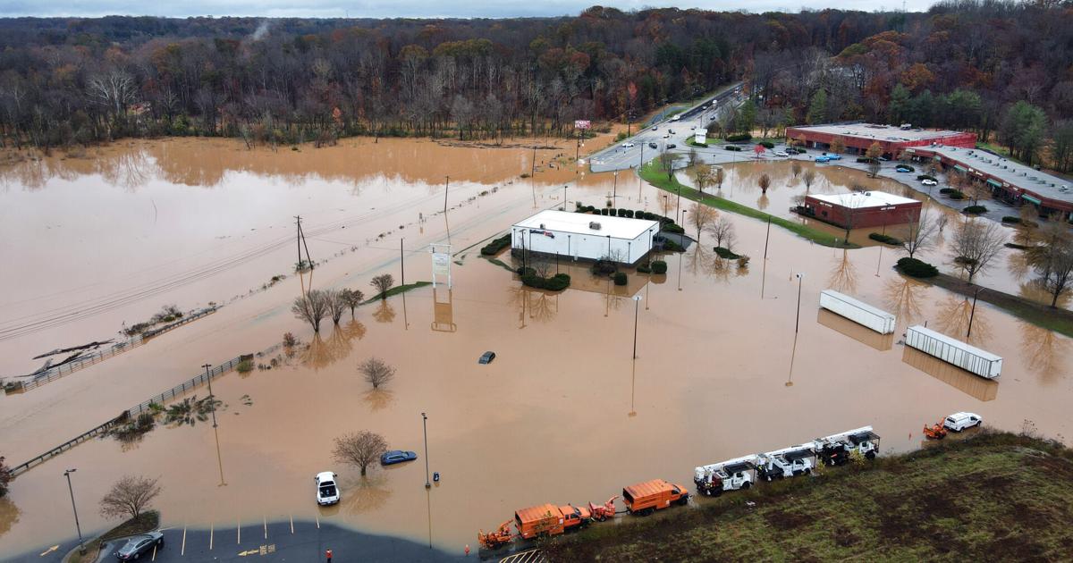
Winston-Salem and Greensboro have long experienced periodic flooding, primarily from creeks at the heart of the cities’ aging stormwater control systems. The hypothetical storm would overwhelm them like never before.
A limited look at impact
Computer modeling from the North Carolina Emergency Management agency’s Flood Inundation Mapping & Alert Network predicts potential flood levels. However, the tool only covers areas near U.S. Geological Survey river and stream gauges and reflects “a minimum baseline” for water levels.
Based on the flood inundation system, Davis offered this partial sample of impacts for his hypothetical storm:
Winston-Salem
• Muddy Creek would wash over – and perhaps wash out – a stretch of Robinhood Road, including the entrance to Jefferson Elementary School, and water would reach into parts of surrounding neighborhoods that back up to the creek. Farther south, near Clemmons, portions of Interstate 40, U.S. 421 and Peace Haven Road would likely be underwater.
• Salem Creek would spill over its banks between Clemmonsville Road and Peters Creek Parkway, and the entire Marketplace Mall complex, which has flooded in the past, would be swamped by several feet of water.
• Brushy Fork Creek south of Smith Reynolds Airport would overflow onto the surrounding land, including homes along Kincaid Drive and the Evergreen Cemetery. “When that happened in the town of Princeville during (Hurricane) Floyd, caskets with air pockets rose up out of their shallow graves and floated away,” Davis recalled.
Greensboro
• Horsepen Creek would flood sections of Battleground Avenue, Interstate 840 and surrounding roads, cutting off access to Cone Health MedCenter. Old Battleground Road would be almost three feet underwater.
• The “already flashy” North Buffalo Creek would flood Revolution Mill, North Church Street and Benjamin Parkway, while South Buffalo Creek would put McConnell Road and Gate City Boulevard under more than four feet of water
These and other areas in both cities and surrounding communities would experience flood-related damage that, at a minimum, severely disrupts daily life, takes years to remedy and, at worst, leads to loss of life.
“The lesson is that even if this worst-case scenario never happens here – and we sure hope that it doesn’t – we’ve seen it happen in other parts of North Carolina, so those of us who live in the Triad shouldn’t feel like we’re immune to that sort of storm happening here,” Davis concluded. “If anything, a year after Helene and only weeks since Chantal in our backyard here in the Piedmont, we should treat this time as borrowed time to think about how to prepare for a storm like this and what we’ll do if and when it happens.”
John Deem covers the Triad for the Winston-Salem Journal and Greensboro News & Record. Contact him at john.deem@lee.net
Local Weather
Get the daily forecast and severe weather alerts in your inbox!
* I understand and agree that registration on or use of this site constitutes agreement to its user agreement and privacy policy.
john.deem
Get email notifications on {{subject}} daily!
Your notification has been saved.
There was a problem saving your notification.
{{description}}
Email notifications are only sent once a day, and only if there are new matching items.
Followed notifications
Please log in to use this feature
Log In
Don’t have an account? Sign Up Today