Copyright Newsweek
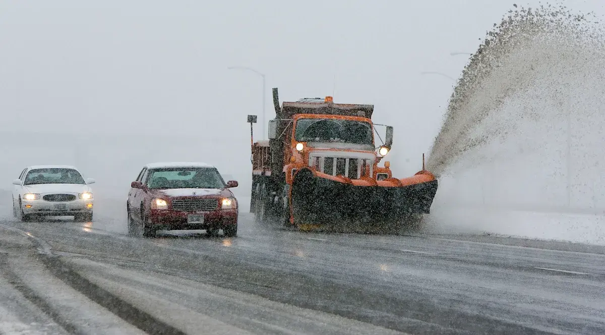
Roughly a dozen roads in Idaho and Montana were impacted by a winter storm on Tuesday morning, prompting National Weather Service (NWS) meteorologists to issue a winter weather advisory for the region, warning drivers to exercise caution when traveling in the affected areas. NWS meteorologist Travis Booth told Newsweek the snow began to fall in Northwest Montana late Monday afternoon. "It then continued through the overnight hours all the way down to probably about 2,500 feet in elevation, so that included quite a few of the valleys," Booth said. "It's continuing to snow lightly, but road impacts are starting to wane." The roads impacted by the storm were primary highways that are open year-round, Booth said. Why It Matters As the season shifts toward colder weather, winter storms are becoming more common, especially in northern states. Several snowstorms have already impacted the Northern United States this season. The storm on Tuesday morning is expected to drop as much as 6 inches of snow in some areas, creating hazardous travel conditions. Even areas expecting lower amounts could still experience travel disruptions, particularly during the morning commute. What To Know NWS meteorologists at the Missoula and Great Falls offices issued winter weather advisories for Montana early Tuesday morning, and meteorologists at the NWS office in Spokane, Washington, issued a similar advisory for Northern Idaho. Numerous roads are included in the advisory area, with meteorologists warning drivers that their morning commute could be challenging due to the snow. In Montana, up to 6 inches of snow is expected to fall. The highest amounts are expected in Glacier National Park, Marias Pass, Bad Rock Canyon, Essex, along Highway 83 Bigfork to Swan Lake, and Polebridge. However, widespread amounts of 2 inches or more could disrupt travel along multiple other highways. Impacted roads include Highway 37 Eureka to Libby, Highway 93 Eureka to Whitefish, Highway 56 Bull Lake Road, Highway 2 Kalispell to Libby, Highway 200 Thompson Falls to Plains, Highway 200 Trout Creek to Heron, Evaro Hill, and I-90 Lookout Pass to Haugan. "Roads, and especially bridges and overpasses, will likely become slick and hazardous," NWS Great Falls said in a winter weather advisory. In Idaho, up to 5 inches of snow is expected, which will impact Lookout Pass and Dobson Pass. The Idaho advisory is set to expire first, at 8 a.m. MST on Tuesday morning. In Montana, the advisories will remain in effect until noon MST on Tuesday. What People Are Saying NWS Great Falls in a winter weather advisory: "Be prepared for slippery roads. Slow down and use caution while driving. If you are going outside, watch your first few steps taken on stairs, sidewalks, and driveways. These surfaces could be icy and slippery, increasing your risk of a fall and injury." NWS Spokane in a winter weather advisory for Idaho: "Slow down and use caution while traveling." NWS Spokane in a post on X on Monday night: "Heads up motorists: Currently seeing some snow covered roads at Lookout Pass this evening. An additional few inches of snow could fall by the morning hours. Expect winter travel conditions tonight along the ID/MT border." What Happens Next Drivers will be most affected during the Tuesday morning commute. People in the impacted areas are urged to follow the advice of local weather officials and remain alert about changing road conditions.