Copyright cambridge-news
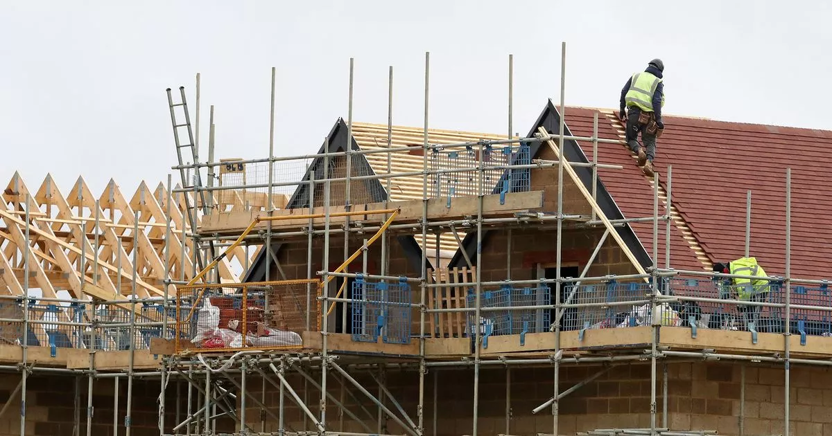
Sites across Huntingdonshire where new housing developments could be built in the coming years have been identified. Huntingdonshire District Council has set out a list of its preferred options for development site allocations in its new local plan. The authority is currently working on a new local plan to guide future development across the district until 2046. A local plan sets out where houses could be built, but also identifies land where businesses can be based, and areas that should be kept as open space. A report published by the district council said that at least 14,587 new homes will need to be found through the draft local plan. The report said the list of preferred options put forward at this stage could see 15,447 new homes built by 2046. The authority has agreed to consult on sites highlighted as its preferred options, before moving to the next stage of the local plan development. The sites identified have been put forward for a range of potential uses including housing, employment, and open space. The housing sites identified also vary in the number of homes proposed, from just a handful, to thousands. Here are all the proposed allocation sites for more than 100 new homes in Huntingdonshire. North Huntingdon Growth Corridor Proposed to allocate 317.2ha of land at Lodge Farm, north of the A141, for a new housing development of around 4,900 new homes. The new homes are also due to include around 450 supported living homes and about 260 extra-care homes. Around 280 bed spaces in nursing and care homes are also proposed. This development could also see the realignment of the A141. Around eight hectares of land could be used to create space for jobs, including for business and service uses and general industrial uses. A further 6.5ha of land is proposed to be used for at least one local centre, including potential shops and a neighbourhood health facility. A secondary school and three primary schools could also be included in the development, along with indoor and outdoor sports and recreation facilities. The preferred options draft local plan said: “Lodge Farm offers the opportunity for creation of a substantial new community benefitting from both the advantages of a purpose designed new settlement and its immediate co-location with the long established market town of Huntingdon.” Wyton Airfield Proposed for 253.9ha of land at Wyton Airfield to be allocated to a development of around 4,000 new homes. These homes are proposed to include around 400 supported living homes and around 240 extra-care homes. Around 250 bed spaces are also proposed in nursing and care homes. Around 15ha of land is proposed to be used for employment uses, such as for general industrial use and business and service uses. The draft allocation also said around 6.4ha of land could be used to create a local centre including “commercial, business and services uses”, as well as a health facility and space for other community uses. A secondary school and up to three primary schools are also proposed, as well as indoor and outdoor sports and recreation facilities. The possibility of building new homes on the airfield has been raised before. A planning application was put forward in 2019 to build up to 700 new homes at the site, but was withdrawn in 2020. The draft plans said: “Any masterplan for Wyton Airfield should demonstrate how it has endeavoured to maximise the opportunities arising from its unique juxtaposition with RAF Wyton to develop synergies between economic growth within the allocated site and the intelligence and geospatial specialisms hosted at RAF Wyton.” Land east of Loves Farm (Tithe Farm) Land to the east of Loves Farm is proposed to be allocated for a development of around 1,100 new homes. A primary school and nursery facilities are also proposed, along with a neighbourhood centre including shops and community facilities. Indoor and outdoor sports and recreation facilities are also proposed. The plan said: “The site is located east of Loves Farm Two and north of Wintringham Park, a strategic mixed use development. Opportunities to integrate development with the nearby residential areas through clear visual and physical links must be addressed through the masterplan. “The site offers the opportunity to improve the quality of the immediate locality and provide new homes in a highly sustainable location within access to the market town of St Neots and the railway station.” North of Houghton Road The plan proposed to allocate 23.9ha of land north of Houghton Road in St Ives for a development of around 350 new homes. The plans said: “The site is technically within Wyton-on-the-Hill parish, but the site immediately adjoins the edge of St Ives and has a greater functional relationship with the town. “Due to the site’s edge of town location and its visual prominence in the landscape, a comprehensive parameter plan is required to ensure a holistic approach to the design of development integrating it with St Ives and mitigating landscape impact. “Development must also be sensitively designed and master planned to minimise the perception of coalescence of St Ives and Houghton and Wyton.” Ramsey and Bury RAF Upwood, Phase three The plan proposes to allocate 17.69ha of land at RAF Upwood for a development of around 170 new homes, as well as areas of open space and play parks. The report said the site offered an opportunity to redevelop the former RAF base and make “effective use of land”. The allocation is proposed as part of the wider development of the site. Godmanchester Land south of Godmanchester off the A1198 It is proposed for 39.6ha of land south of Godmanchester on either side of the A1198 could be allocated for a development of around 520 new homes. The report said: “Originally submitted as five separate sites it has been drawn together as one site to promote a comprehensive scheme to maximise its ability to integrate into the existing town and reflect the need for a collaborative approach to provision of a new junction with the A1198. This also allows for a strategic response to mitigating the flood risk arising from Stoneyhill Brook.” Little Paxton Land West of Great North Road Land to the west of the Great North Road is proposed to be allocated for a development of around 220 homes. The draft plan said this development would contribute to meeting the district’s housing needs and would be “sustainable located” with access to services and facilities in St Neots. Land West of Glatton Road The draft plan proposes to allocate 12.5ha of land off Glatton Road for a development of around 330 homes. The site sits next to an already approved development of 340 homes. The plan said: “The site would be suitable for low density homes to reflect the lower density context of larger villages and location within a local services village.” Land east of Glatton Road A further plot of land off Glatton Road is also proposed to be allocated for the development of around 170 new homes. The site is next to the Brookside Industrial Estate and the draft plan said any proposals would need to demonstrate how it will “respond to the employment development to the south”, as well as how it will integrate with the already approved development for 240 new homes. West of Toll Bar Way and Green End Road Land on the edge of Sawtry to the west of Toll Bar Way is proposed to be allocated for a development of around 330 new homes. The draft plan said the site has the “potential to provide built development of a scale that could be integrated into the existing place and community”. College Farm, West of Parkhall The draft plan proposes to allocate 6.3ha of land at College Farm for the development of around 120 homes. The plan said the site is “sustainably located” within access of the services and facilities in Somersham and would help contribute to the housing needs of the district. South of College Farm A further proposed allocation for 140 homes to be built on land south of College Farm is also proposed to be included in the plan. The draft plan said this site is also “sustainably located”, as people would be able to access services and facilities in Somersham. Hemingford Abbots The Lattenburys Over 240ha of land between the A1307 and the A14 is proposed to be allocated for a development of around 3,800 homes, including around 375 supported living homes and around 150 extra-care homes. Around 160 bedspaces are also proposed to be provided in nursing and residential care homes. The area highlighted for the potential allocation includes the Woodgreen Pets Charity site, which the draft plan said would need to be kept and an additional 10ha of land made available to meet its future expansion needs. The draft plan said: “This site offers the opportunity for creation of a substantial new community, promoted under the name of ‘The Lattenburys’, where developers’ aspiration is to create two linked villages situated within the lower elements of the landform designed to generate a village-style living experience, while in a wholly new community.” Needingworth Giffords Park, East of B1040 Land on the edge of St Ives, east of the B1040, is proposed to be allocated for a development of around 1,750 new homes. A care home is also proposed, alongside a local centre offering shops, health services, and a mobility hub. A primary school is also proposed to be included, as well as a 3.3ha solar farm. The draft plan said Gifford’s Park is technically within Holywell-cum-Needingworth, but sits on the edge of St Ives. It said a masterplan would be needed to show how any development would integrate with St Ives. Land South of A1123 A development of around 290 homes is proposed to be allocated for 35ha of land to the south of the A1223. The draft plan said this site would be “suitable for very low density homes to reflect the edge of settlement location”. North of 23 to 33 Oundle Road Land to the north of homes on Oundle Road is proposed to be allocated for a development of around 165 homes. The draft plan said around 4ha of open space would also need to be used to “safeguard against flooding”. To get more breaking news and top stories delivered directly to your phone, join our new WhatsApp community. Click this link to receive your daily dose of CambridgeshireLive content. We also treat our community members to special offers, promotions, and adverts from us and our partners. If you don’t like our community, you can check out any time you like. If you’re curious, you can read our Privacy Notice .