Copyright 9news
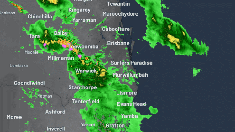
Brisbane has recorded its wettest day since Tropical Cyclone Alfred after heavy rain drenched south-east Queensland overnight. Two distinct trough lines hit the state with bands of heavy rain between midday and midnight, lashing the city with its heaviest October downpour in five years. Several locations across the state recorded more than 100mm of rain in the 24 hours this morning, according to Weatherzone. READ MORE: At least eight Queensland schools taught students about the wrong Roman leader for a whole semester Oyster Creek, near Burleigh Heads, recorded just shy of 130mm of rain. The weather systems also nudged into north-east NSW, where 123mm fell at Goonengery, inland from Byron Bay, Weatherzone said. In Brisbane, the airport received 61mm, the highest rainfall since Cyclone Alfred battered the city in March. The city was already in recovery mode after fierce storms left 21,000 homes without power on Monday night. More than 11,000 insurance claims were made across the city after ferocious winds brought down trees and damaged properties across Brisbane. Queenslanders are continuing a heavy clean up after wild storms brought heavy rain, 100km/h winds, golf-ball-sized hail and 250,000 lightning strikes Skies have cleared across much of Queensland today but showers and storms are expected to stick around for much of the week. DOWNLOAD THE 9NEWS APP: Stay across all the latest in breaking news, sport, politics and the weather via our news app and get notifications sent straight to your smartphone. Available on the Apple App Store and Google Play.