Copyright NBC10 Boston
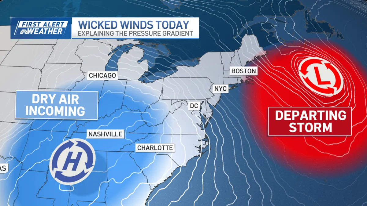
The weather pattern is picking up the pace over the next five days. After Monday's dreary skies and rain, Tuesday brings a sharp change with clear skies and gusty winds. Highs reach the mid-50s, but it won’t feel that warm with the wind chill making it feel closer to 50 degrees. A Wind Advisory remains in effect until 7 p.m. for sustained winds around 25 mph and gusts around 45 mph. Damaging winds could blow down trees and power lines, and travel may be difficult, especially for high-profile vehicles. Unsecured outdoor items should be brought in, as gusty winds could toss them around. With even windier days coming, it's best to keep the yard free from objects that can blow around. The next round of active weather arrives Wednesday afternoon with scattered showers, followed by a very windy evening and overnight into Thursday. A First Alert and High Wind Watch is already up as gusts could reach up to 65 mph before sunrise Thursday. Damaging winds could once again lead to downed trees and power outages. The pattern stays unsettled into the weekend with more cold fronts Friday into Saturday and again Sunday into Monday. That final cold front will usher in the coldest stretch of air so far this season, with highs in the low 40s and lows dipping into the upper 20s to low 30s, even along the coast.