Editor’s note: This is part of The Know’s series, Staff Favorites. Each week, we offer our opinions on the best Colorado has to offer for dining, shopping, entertainment, outdoor activities and more. (We’ll also let you in on some hidden gems).
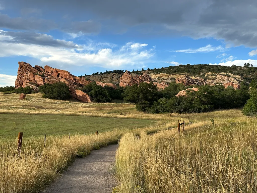
Tucked into an open space behind twin hogbacks, with a series of red rock outcrops and pinnacles reminiscent of Red Rocks Park, South Valley Park is one of the most enchanting places to hike in the metro area.
Located just south of Ken Caryl, South Valley Park is a gem in the Jefferson County Open Space system, a geological marvel. It has beautiful, mellow trails, one of which takes hikers on a path with stunning red rock formations on both sides.
Lest you think I’m exaggerating how special this park is, the last time I went there — shortly before sunset a couple of weeks ago — I saw a half-dozen teenagers posing for senior photos. There was a couple having wedding engagement photos taken, another having a family photo taken with their baby.
I think the best way to enjoy South Valley Park is to park at the north trailhead and hike south on the Coyote Song trail, which features red rock formations on both sides. To the east looms a hogback. About 0.6 of a mile from the trailhead, a short spur trail called the Lyons Back trail takes hikers 0.2 of a mile to a viewpoint atop the hogback that reveals a valley and a parallel hogback further east.
South Valley’s red rocks are part of the same Fountain Formation that includes Red Rocks Park, Roxborough Park and Boulder’s Flatirons. It dates back 300 million years, according to Joanna Redwine, a geologist at Colorado School of Mines and the Colorado Geological Survey. Moving from west to east, the first hogback is part of the tan-colored Lyons Formation and dates back 280 million years. The second hogback is part of the Dakota Formation and is 100 million years old.
A mile down the Coyote Song trail is an intersection with the Prairie Falcon Trail. Taking a right turn there for 0.2 of a mile leads to the Swallow trail, which returns hikers to the north trailhead. That loop yields a two-mile hike with 300 feet of climbing, not counting the short spur trail up to the hogback. It’s a relatively easy hike that pays big dividends in terms of beauty and solitude.
For those who want a more challenging workout, there is a loop trail to the west on the other side of South Valley Road called Grazing Elk, located on a relatively flat, elevated grassland that offers great views of the rock formations to the east. To reach that trail, turn northwest where Coyote Song intersects with Prairie Falcon. Stay on Prairie Falcon where it intersects with Swallow. That takes hikers south to the crossing at South Valley Road. Doing Coyote Song, Prairie Falcon, Grazing Elk and Swallow back to the north trailhead yields a 6-mile hike with 700 feet of climbing.
At the south end of Grazing Elk, the Rattlesnake Gulch trail provides access to Deer Creek Canyon Park on the other side of Deer Creek Canyon Road.
For me, the best time to visit South Valley Park is in late afternoon. It’s a fun hike in the morning, but the ridges to the east are largely in shade then. It’s far more beautiful in the evening when the setting sun best illuminates the park’s multi-hued rock formations. That makes it an ideal destination for a short hike after work.