By Taite Johnson
Copyright walesonline
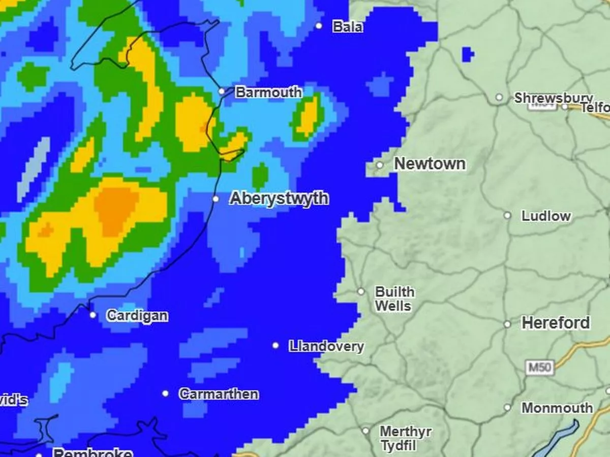
Heavy rain, strong winds, and marked temperature contrasts are expected across the UK over the coming days. Unsettled conditions will prevail for many with heavy rain and strong winds at times, with a 21-hour weather warning on the way. However, ahead of the weekend, Friday – September 19 – is set to be drier in most parts before the rainfall spreads from the west later in the day. The Met Office forecast for Wales on Friday states: “Increasingly cloudy in the west with rain and drizzle pushing north-eastwards, turning heavy at times. Some brighter and drier intervals in the east. Winds continuing to ease. Feeling humid. Maximum temperature 20 °C.” The warning is in place from 9am on Saturday until 6am on Sunday with Met Office chief meteorologist, Paul Gundersen, saying: “A deep area of low pressure is bringing heavy rain to Wales, Northern Ireland and western Scotland today as well as strong winds to the far north of Scotland at first. Elsewhere, low cloud and muggy conditions dominate the south. “Sunny spells are expected in the southeast and north tomorrow, but rain continues to affect the northwest, with 50–80mm of rain possible in Cumbria within 24 hours. “The southeast will see a brief spell of very warm, muggy weather over the coming days as warm air is pulled in from the south. Highs of 24°C are expected today and of 26–27°C on Friday. This is unusually warm for the second half of September but not exceptional.” Other than areas in north Wales including Holyhead and Caernarfon, Wales will see dry spells on Friday morning from around 7.30am, remaining dry throughout the day. Around 3pm on Friday west Wales and areas nearing south Wales will begin to see light rainfall that will continue throughout the night. For the biggest stories in Wales first, sign up to our daily newsletter here Wales will see heavier rainfall in the evening and overnight on Friday as rain comes from the west. Although rain will get heavier from the afternoon, places will still feel humid with temperatures expected to reach 20C. As we head through Saturday and into Sunday a new low-pressure system moves in from the southwest bringing heavy rain, strong winds and a risk of thunderstorms, which will gradually ease through Sunday as the weather becomes more showery but fairly cool. This is how it will look by 4pm on Saturday: Yellow National Severe Weather Warnings have been issued for parts of northern England, southern Scotland, western Wales and Northern Ireland. Met Office deputy chief meteorologist, Tom Crabtree, said: “Through this period 20-40 mm of rain is expected to fall widely, with some locations perhaps seeing 60-100 mm, with much of this total falling in just a few hours. From mid-Saturday onwards, increasingly strong gusty winds and perhaps some thunder will also accompany the rainfall, further increasing the risk of disruption. “Strong winds are also likely in southwest England, western Wales and later parts of the northeast. These may potentially exceed 55 miles per hour, however, the exact location and timing remain uncertain at this time. We’re closely monitoring developments and may issue more warnings as the situation evolves. It’s important to stay up to date with our forecasts over the coming days.” As the low-pressure system pulls away to Scandinavia late on Sunday a cooler air mass will spill in from the north, replacing the recent warmth and there is a chance of snow over the very highest mountain peaks by the end of the weekend. Looking further ahead, the forecasting agency says high pressure is expected to build, bringing a brief spell of more settled weather.