With Hurricane Gabrielle having drifted out to sea as a downgraded Category 2 storm in the North Atlantic, all eyes have shifted to a pair of tropical disturbances in the southwest Atlantic.
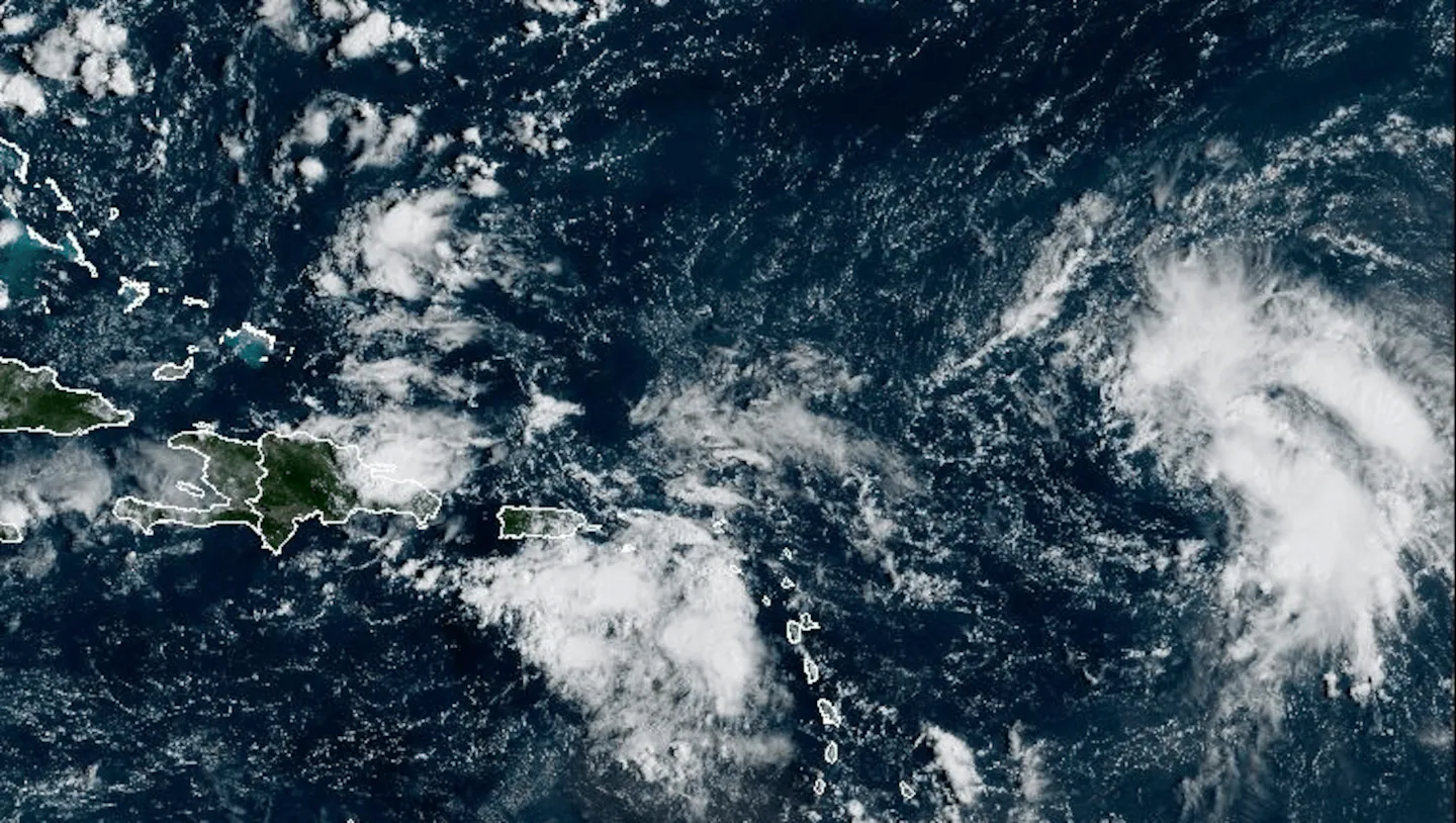
The stronger of the two — Invest 93L — is an area of low pressure holding a cluster of thunderstorms about 700 miles east of the Leeward Islands, while less than a thousand miles to the west is Invest 94L, which is very close to Puerto Rico.
Both systems have a good chance, 80 percent or higher, of developing into a tropical depression or tropical storm within the next several days. As of now, both areas are moving in somewhat different directions, with Invest 93L tracking more to the northwest. However, that may not be the case for very long since Invest 94L could curve quickly north. There is considerable uncertainty about what will unfold over the next two days and whether either one will ultimately be a land threat.
As of now, it appears that these two storms are far enough apart to avoid any interaction, but there is the chance that one may attempt to merge with the other, which would throw any forecasting at this point out the window. This type of merging is called the Fujiwhara Effect, where two tropical systems rotate around a common center, with one storm eventually absorbing the other. The chances of this happening are low, but not impossible. What we do know is that the western storm, Invest 94L, has a more hostile environment to work through.
Advertisement
Here are the latest maps on what Gabrielle and potentially future Tropical Storms Humberto and Imelda are up to in the tropics:
Advertisement
Right now, there is a divide between the models, naturally so, as hot sea surface temperatures, the fuel for hurricane development, try to overcome moderate wind shear. The Euro and Google’s AI models suggest that the western system may make landfall on the Carolinas, while the eastern system curves out to sea. Of course, these forecast tracks will change on a daily basis over the next few days.
Look at how the Euro model, below, shows the two systems as they move closer to the East Coast, with Invest 94L to the west, pulling back to the south.
There is a low chance for a full Fujiwhara Effect to occur. First, we need formidable storms to come to life, then we need them to track within 850 miles of each other. But, some models suggest that the western storm may be directed back south from the eastern storm’s influence. Like I said, this is very much in the air.
This hurricane season is reawakening and showing signs of life after a historic lull from late August through the peak of the season, Sept. 10, when no named storms were active.
Ken Mahan can be reached at ken.mahan@globe.com. Follow him on Instagram @kenmahantheweatherman.