By Resty Woro Yuniar
Copyright scmp
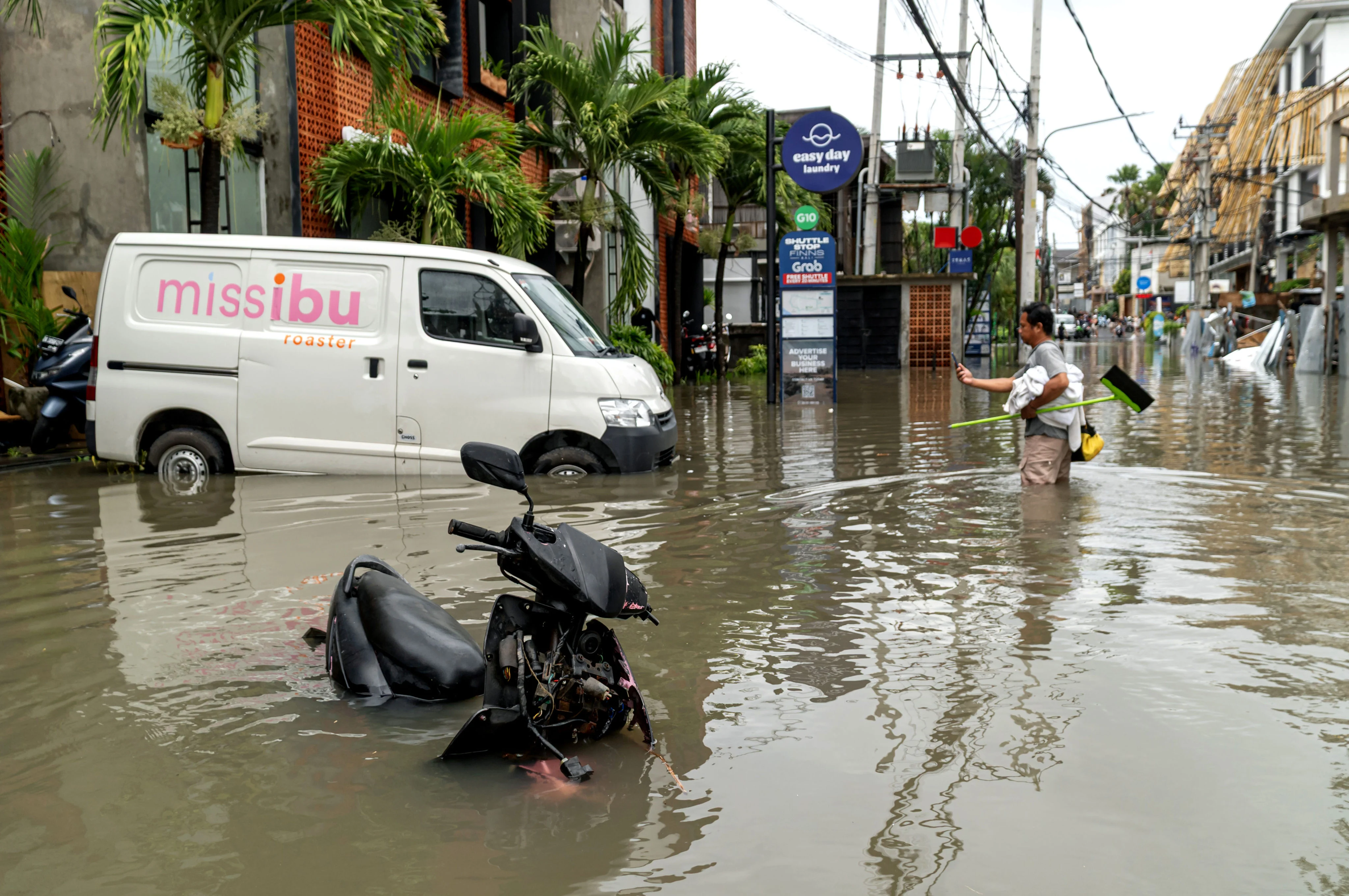
A surge of deadly floods in Bali has reignited concerns over the Indonesian resort island’s overdevelopment, with planning and green experts warning that rapid urbanisation, weak environmental controls and mass tourism have pushed it towards an ecological tipping point.
Flash floods hit parts of the island last Wednesday, killing 18 people and displacing 149 others, the national disaster agency said on Monday. The disaster was caused by extreme rainfall on September 9 to 10, which was recorded at more than 200mm (7.9 inches) per day, although other factors had exacerbated the situation, including piles of garbage blocking the riverbanks, the agency said.
“The ministry of environment stated that more than 200 tons of waste carried by the currents has blocked the rivers, causing flooding into residential areas,” Abdul Muhari, a spokesman with the agency, told reporters on Monday.
The floods last week mostly affected the provincial capital of Denpasar and regencies such as Badung, Gianyar, Buleleng and Karangasem. Floods hit Denpasar and Badung again on Monday following hours of heavy rainfall.
Abdul warned that massive floods in Bali were expected to occur again “within 50 years or 100 years”.
The clearing of forests and agricultural land for housing and commercial facilities had reduced Bali’s ability to absorb rainfall, Abdul said. Between 2012 and 2019, Bali lost 553 hectares (1,366 acres) of forest land and nearly 650 hectares of agricultural land, he added.
“If areas with extreme rainfall are dominated by buildings, flooding will easily occur.”
His statement echoed the concerns of Hanif Faisol Nurofiq, minister of environment, who said last week that Bali’s landscape had been “disturbed” by the conversion of green spaces into hotels, villas and other buildings that sit atop hills or in the middle of rice fields. He has asked the Bali government not to grant permits for new villas and hotels that could pose a threat to the environment.
According to the ministry of environment, only 3 per cent of the 49,500-hectare Ayung watershed remains forested. Ayung is Bali’s longest river, whose downstream areas include major towns such as Denpasar, Bangli, Badung and Gianyar.
In response to Hanif’s order, Bali’s governor Wayan Koster said on Sunday that his administration would stop issuing permits for “hotels, restaurants and other facilities that convert productive lands, let alone rice fields”.
From hereon, conversion of productive land into commercial facilities will not be allowed, according to Wayan Koster.
The Bali government would also “selectively” grant permits for individual land owners wishing to build houses on productive land, he added.
Mass tourism impact
The loss of farmland and forests in Bali is due mainly to the booming hospitality industry, which has attracted investors and travellers, who prefer “scattered” villas in locations such as on the cliffs or among rice fields rather than traditional hotels, according to I Nyoman Gede Maha Putra, a spatial planning expert at Warmadewa University in Denpasar.
“Bali is now a popular investment destination because the return on investment is relatively high compared to other regions. As a result, it attracts a large number of investors, especially in tourism [accommodations],” Maha Putra told This Week in Asia.
“Several government policies have fuelled the property boom, such as digital nomad visas. This has led to the construction of many new villas. These digital nomads avoid staying in hotels, which are too expensive for them. They rent one villa for four to five people, allowing them to save money.”
In 2024, Bali attracted 6.3 million foreign tourists, far exceeding its population of 4.3 million. Indonesia recorded US$16.7 billion of tourism revenue last year, of which 44 per cent came from Bali.
Rapid tourism growth had also changed the mindset of local landowners, who viewed their lands as “a tool for accumulating capital” instead of as a means to provide service for villagers like in the past, Maha Putra said.
Some developers do not abide by the “traditional guidance” for building housing complexes – specifically, that they must be built on infertile and high land, and avoid building around water sources and riverbanks, according to Maha Putra.
Maha Putra suggested “an alignment” of control in the banjar, or Bali’s community association, and decision making at the district and national levels so that “communities can influence and control land use” in their areas.
Made Krisna Dinata, a director at the green group Walhi in Bali, said whenever a paddy field was converted for commercial use, the island lost a subak, or Bali’s customary irrigation system dating back to the 9th century and recognised by Unesco as a World Heritage site for its cultural heritage.
“Ecologically, rice paddies and their subak serve significant ecological functions. One hectare of agricultural land, with a depth of 7cm [2.8 inches], can hold 3,000 tons of water,” Krisna said.
“Many agricultural lands are now being converted into buildings, leading to disasters and putting Bali on the brink of an ecological crisis and vulnerable to climate disasters, such as flooding.”
According to Walhi, from 2018 to 2023, Tabanan became the regency in Bali that suffered the most agricultural land losses at around 2,676 hectares, followed by Gianyar, Badung and Denpasar.
Krisna also criticised some “strategic projects” planned by the Bali government, such as the construction of the Gilimanuk-Mengwi toll road spanning 96.84km (60 miles) in length, which would connect the busy port of Gilimanuk with Bali towns but would “destroy 540 hectares of agricultural land”.
“Bali is already vulnerable. The Balinese government must carry out a total evaluation of all [infrastructure] projects in Bali, enforce spatial planning regulations as strictly as possible, and make efforts to restore and protect ecosystem components that contribute greatly to flooding mitigation,” Krisna said.