China claims to have turned the tables in orbit.
One of its satellites recently photographed a US “surveillance” satellite allegedly observing Chinese space assets.
Analysts describe it as a striking example of tit-for-tat monitoring in the fast-evolving space domain.
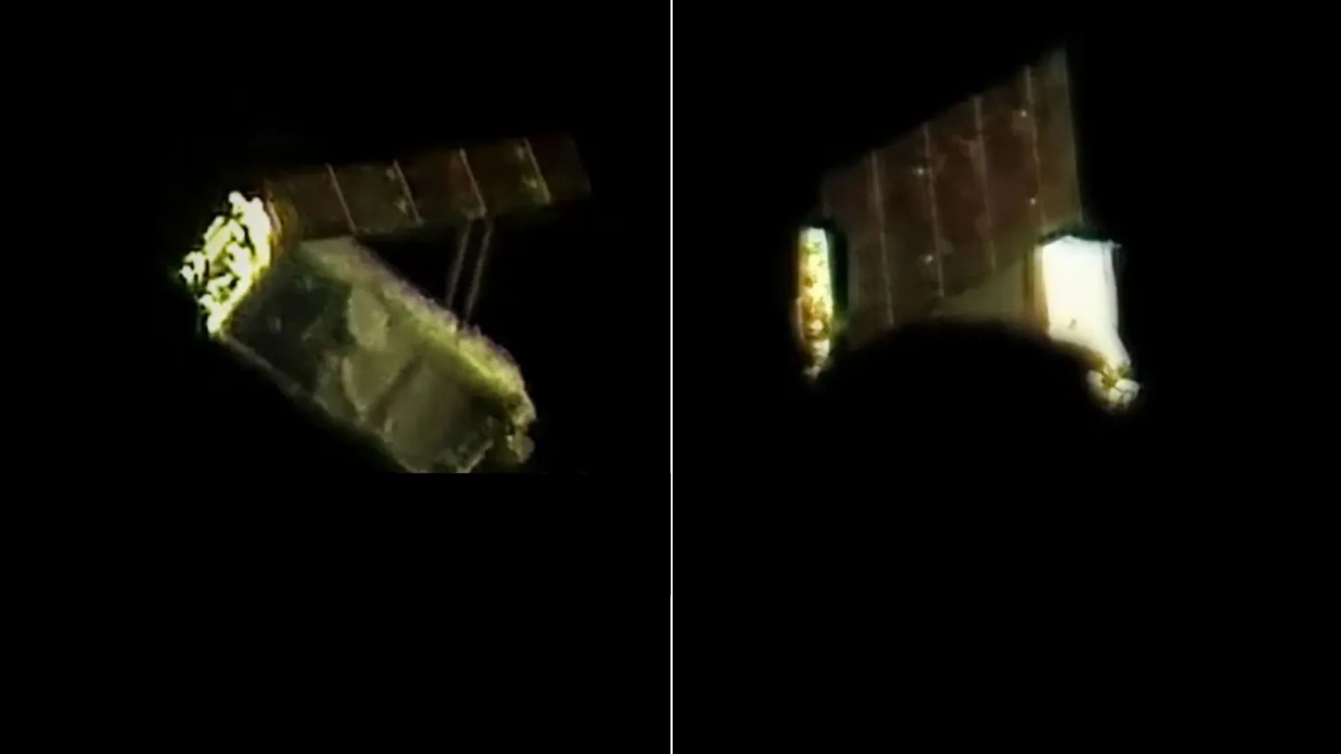
On September 8, a Jilin-1 satellite from Chang Guang Satellite Technology captured four images of the American WorldView Legion satellite from about 40 to 50 kilometers (31 miles) away.
The South China Morning Post reported that the images were released on the company’s official social media account last weekend. It marked the first time Chang Guang publicly shared dynamic pictures of another satellite in orbit.
Following a US observation
This move came just two months after US-based Maxar Intelligence released images of China’s Shijian-26 satellite.
On June 3, Maxar’s WorldView Legion satellite took high-resolution photographs of Shijian-26 from 29 and 74 kilometers (18 and 46 miles) away. The shots revealed sharp structural details with clarity as fine as 1.9 centimeters (0.75 inches).
Maxar also posted images of China’s Tiangong space station and even the International Space Station, both captured at 10-centimeter (3.9 inches) resolution.
According to Susanne Hake, general manager of Maxar’s US government business, Shijian-26 is part of China’s newest generation of optical reconnaissance satellites. The quality of the photos highlighted just how advanced orbital observation has become.
Growing satellite capabilities
Chang Guang, China’s first commercial remote sensing company, is expanding fast. It now operates over 100 Jilin-1 satellites, capable of 0.5-meter resolution and revisits of any global location within 10 minutes.
The company produces up to 200 remote sensing satellites and 200 communication satellites each year, signaling its push toward large-scale constellations.
The company has already demonstrated its ability to track rocket launches and even military aircraft during parades. In 2024, it carried out ultra-high-speed laser communication tests, reaching 100 gigabits per second between satellites and ground stations.
Photographing another satellite in motion, however, is much harder. It requires pinpoint tracking and precise control to overcome the challenge of extremely high relative velocities in orbit.
Military analysts say such reverse observation techniques are more than symbolic. They allow real-time tracking, identification, and early warning of orbital activities. These skills are critical for monitoring space objects and can play a role in validating anti-satellite operations.
Rising tensions in orbit
The exchange of satellite imagery highlights a larger reality that space is turning into a contested arena. The United States established the Space Force in 2019 as its sixth military branch.
China followed in 2024 by creating the People’s Liberation Army Aerospace Force, which joined a major parade in Beijing earlier this month.
While China insists its space force focuses on peaceful exploration, incidents have already sparked friction. In 2021, Chinese officials reported that SpaceX’s Starlink satellites came dangerously close to the Tiangong space station twice, forcing evasive maneuvers.
Beijing urged Washington at the time to ensure safer operations and follow international law.
Analysts warn that as both nations strengthen their orbital surveillance and tracking, the risk of misunderstandings will rise. Imaging satellites may be a sign of technological prowess, but they also carry deterrence value.