By Marshall Shepherd,Senior Contributor
Copyright forbes
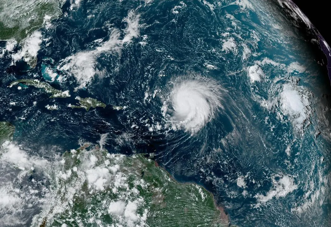
ATLANTIC OCEAN – SEPTEMBER 8: In this NOAA image taken by the GOES satellite, Hurricane Lee crosses the Atlantic Ocean as it moves west on September 8, 2023. Lee reached Category 5, but then weakened slightly to Category 4 as it expected to be a dangerous storm as it moves over the southwest Atlantic. It is too early to know if it will directly affect the United States. (Photo by NOAA via Getty Images)
Getty Images
Typically, the peak of the Atlantic hurricane is around September 10. That happens to be today. Based on climate data, this is the time of year is when the Atlantic basin should be teaming, statistically speaking, with activity. So far in 2025, the “peak week” is unusually quiet. Where are the hurricanes?
Before answering that question, let’s explore why the peak season is typically in the second week of September even though the Atlantic hurricane season begins on June 1. Have you ever walked on the hot sands of a beach in June but felt chilled when you get into the water? Because of the heat characteristics of water, it takes longer to warm up than land. Thus, water temperatures in the ocean lag the air temperatures. As we approach fall, ocean temperatures heat up, so the peak tends to come later in the year.
Atlantic hurricane season activity from 1944 to 2020.
NOAA and NWS
In recent decades, water temperatures have been warm enough to increasingly support tropical development in late spring and early summer. Activity tends to ramp up in August. By September 10, we typically have seen 8 named systems, 3 hurricanes, and at least 1 major hurricane. The 2025 season has seen 1 major hurricane, Erin, but it did not make landfall in the U.S. The Weather Channel’s Jonathan Erdman noted that it has been two weeks since the last storm, Fernand. With only 6 storms, the season is behind the “normal” pace. Erdman also pointed out that a geeky metric meaningful to those of us in the meteorological community is also lagging. He wrote, “Using a metric called the ACE index — which doesn’t just count storms, but also how intense they become and how long they last — 2025 is about 30% slower than average right now.”
Typical progression of the Atlantic hurricane season.
NOAA and NWS
MORE FOR YOU
By the way, this is all great news. Hurricanes kill people and impact entire regions. Many communities are still recovering from Helene and Milton, respectively. While they are fascinating from a scientific perspective, I frown upon the culture of “rooting for storms” and the online “hype” culture that has emerged. Most early season projections called for slightly above average activity, and we still have much of the most active part of the season in front of us. This year, there is plenty of warm water in the Atlantic basin, yet experts at the National Hurricane Center expect fairly quiet conditions for the next ten days. So what’s going on right now?
Sea surface temperatures in early September 2025.
University of Maine, Climate Change Institue
Two maps tell the story. The map below shows a significant area of dry air over the basin. Tropical systems need warm ocean waters, a moist atmosphere, and less wind shear. I will say more about wind shear in a moment, but let’s focus on the dry air. During September, the main development region is the favored area for tropical development. Right now, the MDR is being suppressed by dry air. Last week or so, many of watched a system develop, but it fizzled because of such conditions.
Satellite water vapor imagery shoes dry air in the middle of the atmosphere over the Atlantic region on September 10, 2025.
Dry air is only part of the story. Wind shear is currently not favorable for tropical development. The areas of red on the graphic below indicate stronger wind shear, which tends to disrupt the structure of developing storms. Though not the worst I have seen, there are unfavorable conditions in much of the MDR,
Wind shear conditions in the Atlantic basin on September 10, 2025.
CIMSS/University of Wisconsin website
National Hurricane Center forecaster Eric Blake wrote today, “Tropical cyclone formation is not expected during the next 7 days.” There are hints in some of the models that the broader conditions could become more conducive for development in the coming weeks, but for now, let’s enjoy the calm before any storms. Remember hurricanes are bad, and we don’t want them to form. Unfortunately, they inevitably will.
Typical formation locations in September.
NOAA and NWS
Editorial StandardsReprints & Permissions