By John Davidson
Copyright inverness-courier
ACTIVE OUTDOORS: John Davidson heads for a prominent Caithness landmark for a day of solitude and showers on a trek from the road-end at Braemore
Every time I drive past Berriedale on the A9, I glance over to the triple summit of Scaraben and tell myself that next time I’ll make time to get up there.
At long last, I fulfilled that promise to myself. The forecast wasn’t ideal, with high winds and the potential for showers and low cloud at times, but it wasn’t a complete write-off.
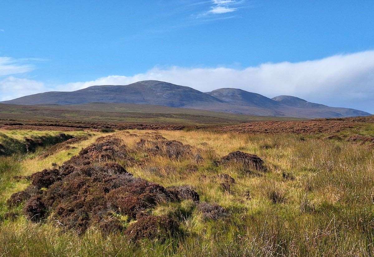
In fact, as I drove down the long single-track road from Dunbeath to the end of the road at Braemore, the sun was shining and lighting up the northern slopes that I would soon follow up to the ridge.
There’s a small parking area just off the road before the private stone bridge that crosses the Berriedale Water at this beautiful part of Caithness. Tracks lead on from here into the heart of the Flow Country, passing the Glutt and heading onto Altnabreac and Forsinard – another route I’m planning to do on the bike one day.
The walk begins by passing the old red phonebox (which is one of the few remaining that still operates as a phone) and crossing the bridge. The track leads away from our desired direction of travel but follow it to a junction where Scaraben is signed left, behind a wall.
The warm sun was shining now, even though I’d donned my jacket in preparation for the cool wind which seemed to have died down for a while.
Looking over to the west, the striking shape of Maiden Pap rose dramatically from the plains, soaking up the sunshine, with the much higher Morven hiding away behind it.
The track follows the river for a short distance then bends right towards a croft house, with another sign pointing straight on past the buildings.
I had originally planned to do this route the opposite way, but the wind higher up was clearly blowing from the west, so I opted to follow the sign and make my way up to Sròn Gharbh, Scaraben’s westernmost summit, first – which would allow me to walk the ridge with the wind at my back.
Related articles:
• New walking guide to NC500 village might help ‘steer people in the right direction’
• Walking the Cat’s Back circuit – Knockfarrel via Knockbain from Dingwall
• More from Active Outdoors
A gate beyond the house leads onto the open hill, but a vague ATV track made the going much easier, so I stuck to it for probably far too long. Eventually, as I realised it was leading me towards the bealach between the east top and the central summit, I struck off below the steepening slopes and headed on a rising traverse to reach the north ridge of Sròn Gharbh.
It was certainly a bit rougher off the notional path I’d been following, but I was making progress at a similar pace, notwithstanding the fact that I kept stopping to take in the views. A rainbow appeared above the Berriedale Water as I looked back, and I had the constant companion of Maiden Pap with the county’s highest point of Morven becoming more prominent the higher I got.
After a flatter shelf I had a steep slog up to that north ridge, where I halted again, looking across the tors of Smean to Morven.
Now it was time for the final push onto the Scaraben ridge proper. It was another short but stiff climb onto the quartzite top, and the wind was really blowing up here. I hunkered down behind the cairn atop Sròn Gharbh to eat lunch and enjoy the location.
Refreshed and ready, it was now a gentle walk along the wide ridge, albeit with the hood up and hat on to combat the rain showers and wind. From here, you pass over the main summit at 626 metres above sea level, with its trig point and circular shelter, before continuing onto the lower East Scaraben.
The views up and down the Caithness coast were impressive from here, and I could make out those tracks heading inland from Braemore over to the Glutt and beyond. The Berriedale Water far below snaked its way out to sea at the village that bears the same name.
It was time for me to head down. I continued briefly along the ridge before dropping north-north-east on the far side of the Dubh-allt, though there was very little water in this black burn today. Making my way through the heather and grass, the land eventually levelled out and I reached the 4×4 track marked on the map that follows the river on its west and south sides.
Turning left, I now followed it past areas which hide the remains of long-lost homesteads in this sparsely populated but beautiful glen. Imagine living here with these Caithness mountains and dramatic river gorges as your backdrop in those forgotten times.
The route passes a footbridge at Achinavish but avoids crossing the river, instead staying with the sheep and passing through several gates to a sharp bend in the river, where the return route crosses a plank bridge over an irrigation channel before meeting our original track near that first croft house.
Turn right here to follow the track back to the bridge at Braemore, where I was happy to linger a little longer in these spectacular surroundings. No one else appeared to have ventured onto these hills today, and I was glad to enjoy the peace and solitude on the triple tops of Scaraben.
Route details
Scaraben from Braemore
Distance 8 miles / 13 km
Terrain Pathless mountain with some ATV and 4×4 tracks; navigation skills required
Start/finish Braemore, at end of single-track road from Dunbeath
Map OS Landranger 17; OS Explorer 444
A ridge walk taking in the three summits of Scaraben in Caithness, with lovely mountain and coastal views
Do you want to respond to this article? If so, click here to submit your thoughts and they may be published in print.