Copyright abc
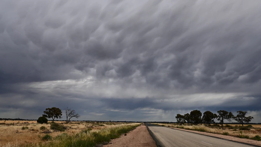
Australia's storm season has shifted into top gear, and the next 72 hours will deliver a combination of rain, showers or thunderstorms to the eastern two-thirds of the country. The greatest threat of severe weather is today. Dangerous supercell thunderstorms, which may even spawn one or two tornadoes, are likely over the highly populated region covering south-east Queensland and north-east New South Wales. While storms are bubbling away near the east coast, a cloudband will also form over South Australia this weekend, and spread up to a month's worth of rain across south-east Australia early next week, including the potential for moderate falls in Adelaide, Canberra, Hobart and Melbourne. Severe thunderstorms target south-east Qld and north-east NSW This weekend's warm and humid weather will provide the ideal conditions for thunderstorms in parts of eastern Australia, but today is no regular run-of-the-mill storm forecast. A volatile mix of atmospheric ingredients has created the perfect conditions for supercell thunderstorms — the least common but most dangerous type of storm. A supercell is defined as a storm with a deep rotating updraft, and they stand out from garden variety storms by their intensity, behaviour and impacts: While a regular storm may have a life span of less than an hour, supercells can travel hundreds of kilometres and last for up to six hours.Supercell updrafts — winds rising vertically — can support the growth of giant hailstones, before they fall to the ground.Destructive wind gusts above 125 kilometres per hour are possible in supercell downdrafts — winds reaching the surface — strong enough to cause property damage and topple trees.Supercells can dump torrential rain, and even spawn tornadoes if the rotation stretches to the surface. While severe storms are possible today anywhere from about Moranbah to Mudgee, the most violent storms should form over south-east Queensland and north-east NSW, including around Brisbane, the Gold Coast and the Sunshine Coast. However, according to the Bureau of Meteorology's (BOM) storm forecast, supercells are most likely in the afternoon and early evening west of Ipswich and north of Armidale, including the region around Toowoomba and Warwick. The BOM's storm forecast today also explicitly mentions a tornado risk, primarily over the inland of south-east Queensland. "Isolated tornado activity also could not be ruled out with the more intense cells," it said. If a tornado does touch down, the damage to property or vegetation will increase exponentially. How to spot a supercell So how will you know if a dangerous supercell is approaching? If the full vertical structure of a thunderstorm is not obscured, you may be able to identify rotation from horizontal grooves and ridges in the cloud. However, a more reliable method of detection is by radar, looking for the following signatures: A large, intense-looking thunderstorm cell, isolated from others, especially if it has already tracked a significant distance.Very intense reflectivity values (heavy precipitation) near the centre, indicating heavy rain and/or hail.A V-shaped signature is often visible as the surrounding environmental winds are split around the storm.A slight veer to the left relative to the movement of other storms.A hook-shaped feature near the core. Below is a classic supercell moving over south-east Queensland from 2019, and while a hook is not present, the V shape, intense core, and prior longevity of the cell, indicates a likely supercell. The BOM will also issue Severe Thunderstorm Warnings when severe storms are developing, and if a supercell is within radar range of Brisbane it will be marked on the warning map as "this storm is very dangerous". Sunday's storm risk is also high over south-east Queensland, and again severe thunderstorms are likely, although less shear and instability will reduce the chance of supercells. The perfect recipe for a perfect storm There are multiple factors that have come together for today's elevated risk of severe thunderstorms: A trough where converging winds will lead to uplift from the surface.A northerly airstream off the Coral Sea providing moisture for cloud development.Exceptionally high instability, essential for vertical storm growth, thanks to warm surface air sitting below cold air aloft.Strong wind shear, a change in wind direction and speed with height, as the surface northerlies back to strong westerly winds a few kilometres above the ground. While the first three ingredients will initiate thunderstorms, it's the addition of wind shear that's critical for dangerous storms. Without shear, a storm's rainy downdraft will fall directly into the updraft and shut off a storm's fuel supply. However, wind shear separates inflows from outflows, which allows growth and intensification. If the shear is strong enough, typically above about 30 to 40 knots from the surface to an altitude of 6 kilometres, the storm's updraft will rotate to form the supercell. For the record, today's shear near the Queensland-NSW border is closer to about 60 knots. Rainband to follow for south-east states Following the weekend thunderstorms, a broad band of rain and storms will sweep across eastern Australia into early next week, extending from the Northern Territory and tropical Queensland right down to Tasmania. The band will not bring widespread severe weather, however, moderate falls of at least 20 millimetres are likely by Tuesday night across much of southern and central Victoria, Tasmania, and the south-east quarter of NSW. Pockets with over 20mm are also possible in eastern parts of South Australia and possibly the central slopes and ranges of NSW. While the rainband will result from the passage of a cold front travelling well north for November, an associated low-pressure system forming nearer to the south-east coast has the potential to bring higher totals closer to 50mm — although the exact location of the low and heavier rain is currently uncertain. A second low will then extend the wet start to November to Western Australia from Tuesday, resulting in rain across nearly the whole of Australia by Thursday.